 |
 |
 SAR Imaging - Frequency, Polarisation and Incident Angle
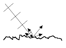
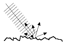
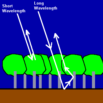
Microwave FrequencyThe ability of microwave to penetrate clouds, precipitation, or land surface cover depends on its frequency. Generally, the penetration power increases for longer wavelength (lower frequency).The SAR backscattered intensity generally increases with the surface roughness. However, "roughness" is a relative quantity. Whether a surface is considered rough or not depends on the length scale of the measuring instrument. If a meter-rule is used to measure surface roughness, then any surface fluctuation of the order of 1 cm or less will be considered smooth. On the other hand, if a surface is examined under a microscope, then a fluctuation of the order of a fraction of a millimiter is considered very rough. In SAR imaging, the reference length scale for surface roughness is the wavelength of the microwave. If the surface fluctuation is less than the microwave wavelength, then the surface is considered smooth. For example, little radiation is backscattered from a surface with a fluctuation of the order of 5 cm if a L-band (15 to 30 cm wavelength) SAR is used and the surface will appear dark. However, the same surface will appear bright due to increased backscattering in a X-band (2.4 to 3.8 cm wavelength) SAR image.
Both the ERS and RADARSAT SARs use the C band microwave while the JERS SAR uses the L band. The C band is useful for imaging ocean and ice features. However, it also finds numerous land applications. The L band has a longer wavelength and is more penetrating than the C band. Hence, it is more useful in forest and vegetation study as it is able to penetrate deeper into the vegetation canopy.
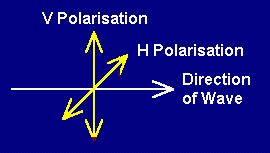
Microwave Polarisation in Synthetic Aperture RadarThe microwave polarisation refers to the orientation of the electric field vector of the transmitted beam with respect to the horizontal direction. If the electric field vector oscillates along a direction parallel to the horizontal direction, the beam is said to be "H" polarised. On the other hand, if the electric field vector oscillates along a direction perpendicular to the horizontal direction, the beam is "V" polarised.
Incident AnglesThe incident angle refers to the angle between the incident radar beam and the direction perpendicular to the ground surface. The interaction between microwaves and the surface depends on the incident angle of the radar pulse on the surface. ERS SAR has a constant incident angle of 23o at the scene centre. RADARSAT is the first spaceborne SAR that is equipped with multiple beam modes enabling microwave imaging at different incident angles and resolutions.The incident angle of 23o for the ERS SAR is optimal for detecting ocean waves and other ocean surface features. A larger incident angle may be more suitable for other applications. For example, a large incident angle will increase the contrast between the forested and clearcut areas. Acquisition of SAR images of an area using two different incident angles will also enable the construction of a stereo image for the area.

 Go to Main Index Go to Main Index
|


