Himalayan Foothills, Arunachal Pradesh, India
21 December 2005
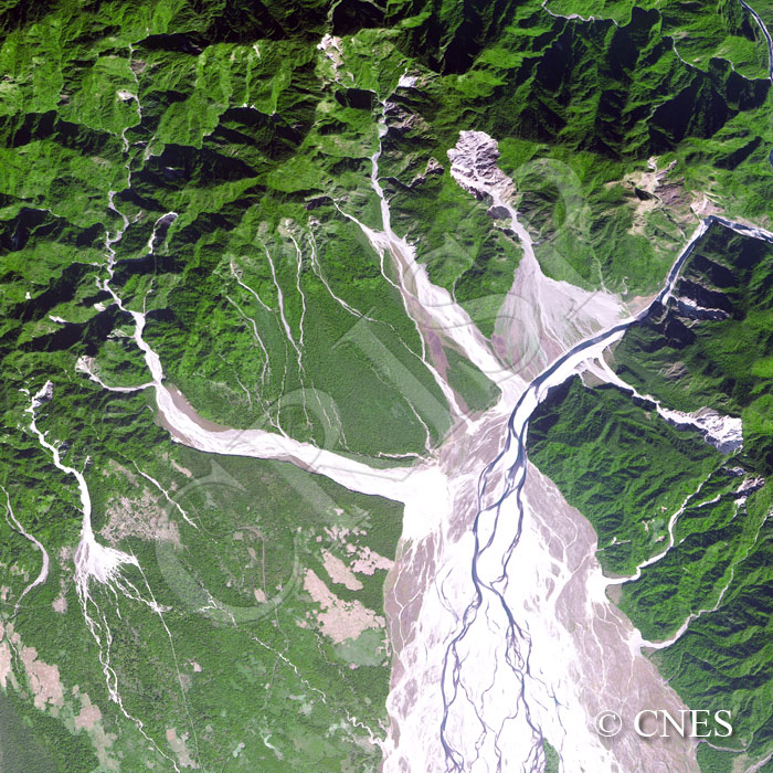
Note: The area of coverage in this SPOT-5 image is approximately 18 km x 18 km.
The reduced resolution image on display has undergone compression and so does not represent the true resolution of the original satellite image.
This is the contact between the steep southern slopes of the Mishmi Hills of the eastern Himalaya and the Plains of the Brahmaputra valley. The slopes are tectonically controlled, heavily dissected by south-flowing streams, and rapidly denuded by a number of landslides. The best-developed landslide is towards the east. Clearly visible are the stepped and curved scar at the source of the slid material, the track of the slide, and the cone of deposition that has reached the main stream in the image, the Dibang. Scaled-down examples of landslides occur westwards, each starting at the same elevation. The landslide-derived high sediment load has caused the rivers to braid, best illustrated by the Dibang. The colour contrast between the green mountain slopes, the reddish-brown landslides, the bright white river sands, and the blue water in the river present a striking mosaic.