Land Development, Southeast Sumatra, Indonesia
15 May 2006
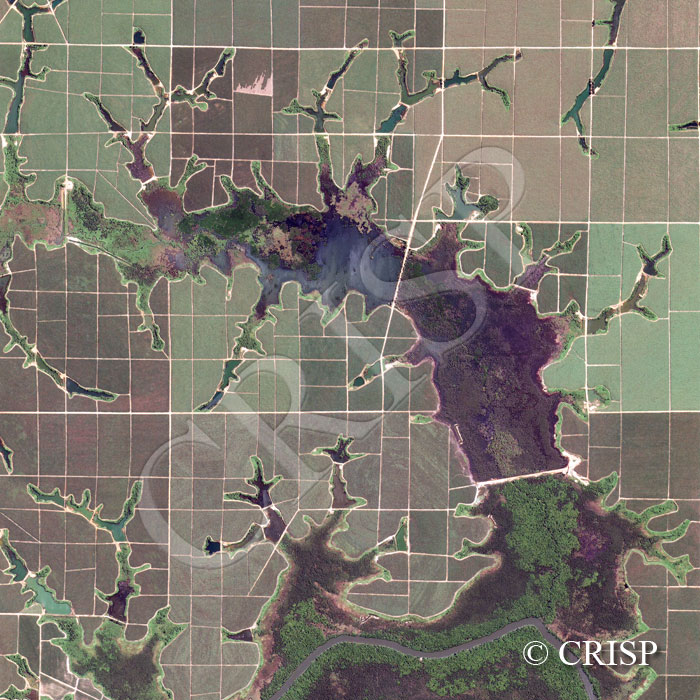
Note: The area of coverage in this IKONOS image is approximately 4 km x 4 km.
The reduced resolution image on display has undergone compression and so does not represent the true resolution of the original satellite image.
The rectangular pattern of roads and farming plots indicates organised use of the land in the coastal swamps of southeastern Sumatra. A bend of the Terusan River that drains this low area is seen towards the south. The river and its tributaries are flowing through low wetlands formed by erosion into the coastal sediment, and the drainage net is spreading through an active gully system. Low swamp vegetation is best developed along the riverbanks. Land away from the drainage lines has been cleared. Roads cross the wetlands on embankments that are slightly wider and water is ponded behind such barriers. The image displays an early stage of land development with newly established roads and plot systems as a harbinger of future change.