Tanakeke Island, South Sulawesi, Indonesia
11 September 2005
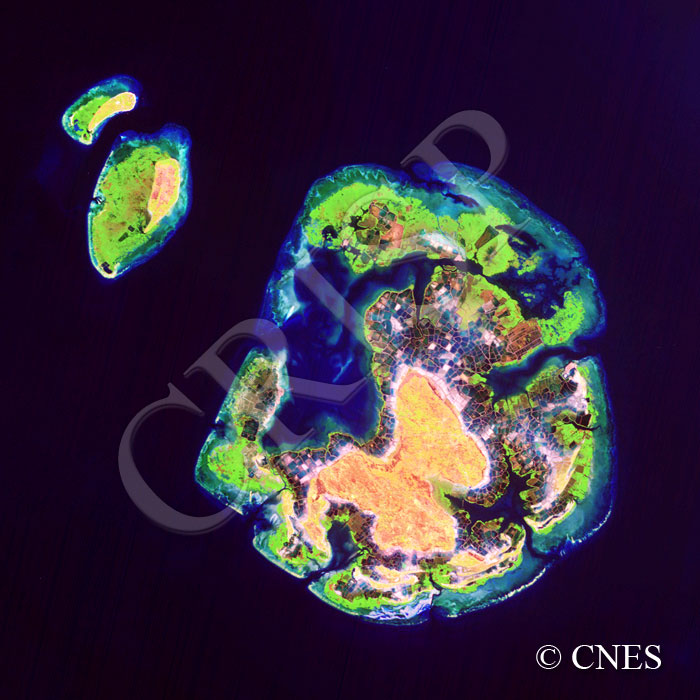
Note: The area of coverage in this SPOT-5 image is approximately 15 km x 15 km.
The reduced resolution image on display has undergone compression and so does not represent the true resolution of the original satellite image.
A butterfly-shaped landmass in the centre of this island is surrounded by a mangrove wetland, which in turn is flanked by a set of coral reefs. The same pattern is seen for the two smaller islands to the northwest. The higher parts of the wetland are currently in aquaculture, the plots indicating various depths as demonstrated by their reflectance. Mangroves still survive at the outer edge, away from the island and close to the marginal coral reefs. Away from the island corals occur at greater depths as demonstrated by the progressively darker shade of blue. The sharp edge of the reef is best seen towards the west of the main island where the reefs end in a straight line.