Dam On The Mekong/Lancang River, Yunnan, China
23 January 2006
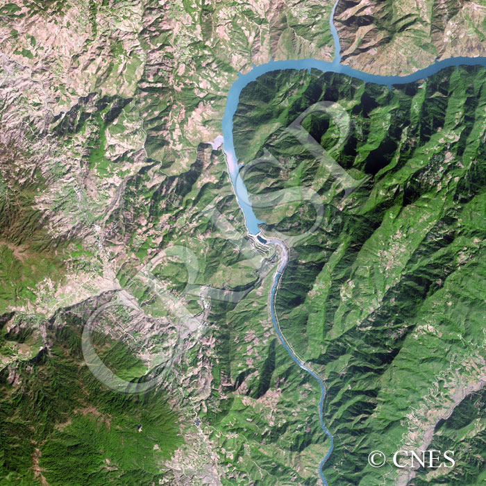
Note: The area of coverage in this SPOT-5 image is approximately 15 km x 15 km.
The reduced resolution image on display has undergone compression and so does not represent the true resolution of the original satellite image.
A cascade of eight dams has been planned along the Upper Mekong (locally known as the Lancang) in the Yunnan Province of China. The Mekong here is a turbulent river, flowing through a steep-sided narrow valley, as seen in the southern part of the image where three rapids can be seen in quick succession. Short, steep tributary streams dissect the mountainous landscape and landslides scar the steep slopes, probably accelerated by the progressive replacement of natural vegetation by farming. A long narrow reservoir extends up the valley of the Mekong behind the Dachaoshan dam, the arms of the reservoir stretching along valleys of the tributary streams.