Arid Plains, Western Australia
20 April 2006
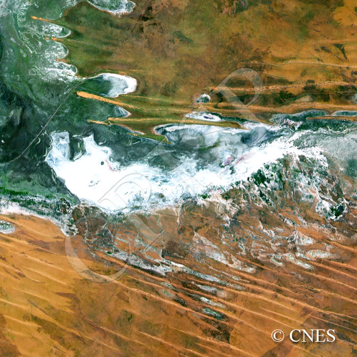
Note: The area of coverage in this SPOT-2 image is approximately 30 km x 30 km.
The reduced resolution image on display has undergone compression and so does not represent the true resolution of the original satellite image.
Long line of sand dunes stretch northwest to southeast across a dried up drainage system at the edge of the Great Sandy Desert, behind the Eighty Mile Beach southwest of Broome. Low vegetation survives towards the northwest in the lower part of the depression where it is possible to identify the outlines of a channel system. A large part of the drainage, however, is marked by bright sandy silt and salt left on the ground after evaporation. Such bright deposits indicate probable former channel bends towards the northwest and a large fish-shaped depression in the centre. A single highway cuts across the northwestern corner of the image, heightening the sense of desolation in the landscape.