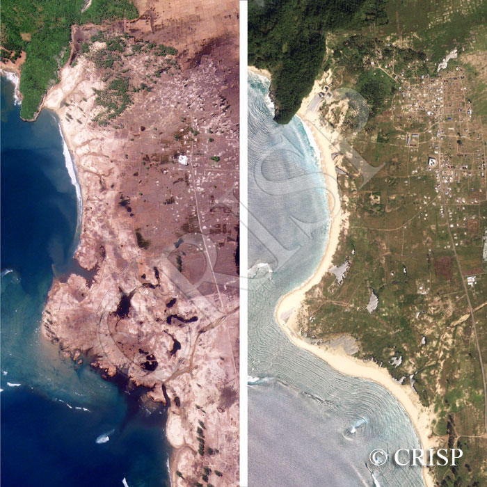
Tsunami Destruction And Recovery, Aceh Coast, Sumatra, Indonesia
Note: The area of coverage in this IKONOS image is approximately 2 km x 2 km.
The reduced resolution image on display has undergone compression and so does not represent the true resolution of the original satellite image.
Last year we showed a pair of images that mapped the devastation from the huge tsunami of 26 December 2004 for the coast near Meuseugit, south of Banda Aceh. This year we show the recovery. The image to the left, repeated from last year, is for 29 December 2004, three days after the tsunami. The one to the right is for the same area on 1 February 2006. As yet very few anthropogenic changes are seen in the village, but the recovery of the coastal features is striking. The beaches in the two bays have been rebuilt, very closely resembling those in existence before the tsunami. The enlarged water bodies on land are being filled in from the edges. Vegetation is returning, especially towards the northeast. On this coast, given a few years, any feature diagnostic of the huge tsunami would tend to be cultural rather than natural.