Bend Of The Yangtze At Shigu, Southwestern China
6 January 2004
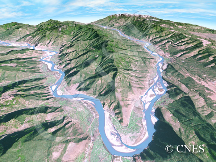
Note: The area of coverage in this SPOT-5 image is approximately 28.5 km x 28.5 km.
The reduced resolution image on display has undergone compression and so does not represent the true resolution of the original satellite image.
A southeast flowing upper Yangtze (locally known as the Jinsha Jiang) displays a remarkably acute bend, turning first northeast and then north. As a result the Jinsha ends up flowing parallel to its upper course but in the opposite direction. This direction change is attributable to tectonic movements related to the formation of the Himalaya Mountains from the collision between the Indian and Eurasian Plates. A tributary joins the Jinsha from the south on top of the bend where the town of Shigu is located. The river displays a braided pattern reflecting seasonality in flow and large floods. Tributaries joining the Jinsha have built alluvial fans at their confluences. These fans and the small flat areas next to the main river are farmed, the lower hillslopes are either cleared or under grass, and the upper slopes carry a tree cover. The mountainous terrain confines roads to the narrow valley along the Jinsha. The 3-D representation was created by using satellite imagery draped over Shuttle Radar Topogaphy Mission (SRTM) digital elevation data and was rendered via Autodesk 3ds Max.