Centre for Remote Imaging, Sensing and Prcessing (CRISP)

CRISP's Research

Contact: crisp@nus.edu.sg Copyright © CRISP, 2001

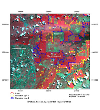
Forest Management, Sumatra


© CNES 1996 . This image has been degraded by JPEG compression at 10% quality level. It does not represent the true quality of a full resolution SPOT image.
This multispectral SPOT image shows clearly the boundaries between plantation (red), bare soil (in light green), and forest (dark red). It is widely used all over the world for systematic mappings of monitoring of the landcover

(i) SAR Image;     (ii) Interferometric SAR Image;     (iii) Back to content page
 
Copyright © CRISP, 2001