|
The use of spaceborne remote sensing for forest applications has been widely demonstrated as an important tool, particularly in global forest cover identification and forest biomass estimation. More importantly, the easy availability of data on a regular basis from operational satellites such as ERS, JERS, RADARSAT and SPOT has created the potential for such an analysis to be implemented as a monitoring tool of the forest biome. This is immensely important in areas where extensive logging activities are prevalent. While optical sensors have been successfully exploited for such studies, their use in tropical areas is severely limited by weather conditions. Indeed, cloud cover poses the greatest restriction to the acquisition of data that may be required at different intervals. This limitation has been somewhat alleviated by the use of Synthetic Aperture Radars (SARs) which are essentially all-weather systems. Using spaceborne SAR sensors, interferometric studies can be carried out using two images of the same areas acquired at two different dates. The coherent addition of these two signals, which forms the basis of what is now called SAR Interferometry, provides useful information about the topography of the terrain. This technique is especially useful for generation of Digital Terrain Model (DTM) from a pair of SAR images. Nevertheless, forest greatly reduces the coherence of radar backscatter while the coherence of the signals from sparsely vegetated areas is maintained at a high level. Thus, interferometric analysis can be applied to yield useful information about land-use patterns. In particular, the interferometric signatures allow for the discrimination of deforested areas from forests. |
|
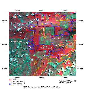
© CNES 1996 . Multispectral SPOT image |
This multispectral SPOT image
shows clearly the boundaries between plantation (red), bare soil (in light green),
and forest (dark red). This type of optical image remains the most appropriate type
of remote sensing data. It is widely used all over the world for systematic mapping
and monitoring of the landcover. Nevertheless, the extensive cloud coverage in
tropical region limits the use of these optical data.
To supplement the lack of optical data, different approaches have been developed
using SAR images. One method uses a set of Amplitude-SAR images acquired at
different dates in order to evaluate changes in landcover. This technique is called
multitemporal analysis. Nevertheless, interpretation of SAR images remains
difficult. |
Another technique is based on the combination of different
components obtained from a set of SAR images. Typically, this approach combines multitemporal analysis
(e.g. two amplitude images) of a set of Amplitude-SAR
images and interferometric analysis using a pair of SAR data.
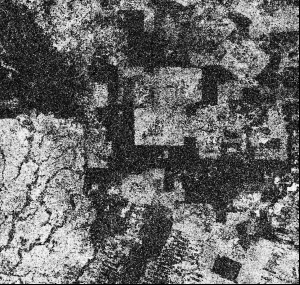
The latter is used to derive a so-called coherence
component which provide a useful information about the
decorrelation of the two SAR signals. A low coherence value is related to an area where the variation of the
target is significant between the acquisition of the two SAR images. This is typically the case over
vegetated areas. In contrary, the coherence remains high over bare land, rock and built-up areas.
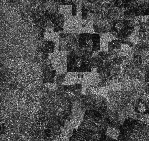
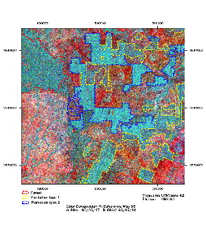
A color composition can be realised using
two Amplitude SAR images and the coherence image.
This image can be compared to the SPOT image of the same area. 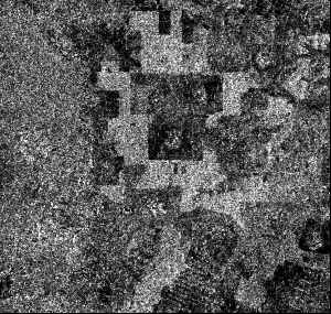
© ESA 1996 |
|