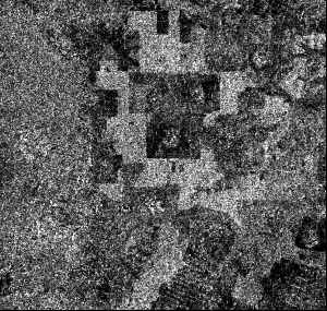
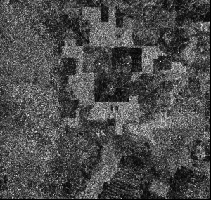
| The Amplitude SAR image is the basic SAR product usually used. The variation of the backscatter between two images gives useful information on the change in landcover. Nervertheless, the radar backscatter intensity could be similar for different types of landuse (e.g. forest and plantation), which is a limitation for landcover classification. | |
 © ESA 1996 . Amplitude Image ERS-1 (17 May 1996)
|
 © ESA 1996 . Amplitude Image ERS-2 (18 May 1996), one day later
|
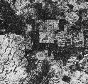
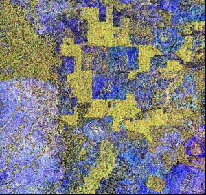
| An additional information could be derived from the original SAR images, using the phase information of the signal. It has been shown that the decorrelation of the SAR signals between two images is linked to the type of landcover. A low coherence value is typically obtained over vegetated areas, where the variation of the target is significant between the acquisition of the two SAR images. On the contrary, the coherence remains high over bare land, rock and built-up areas. A color composition could then be realised combining two amplitude images (given an information on the varation of the radar backscatter intensity between two dates), and the coherence image dirived from a interferometric pair. | |
 © ESA 1996 . Coherence Image
|
 © ESA 1996 . Color Composition of amplitude ERS-1, amplitude ERS-2 and Coherence
|
|
(i) Spot Image; (ii) SAR Image; (iii) Back to content page |
|