|
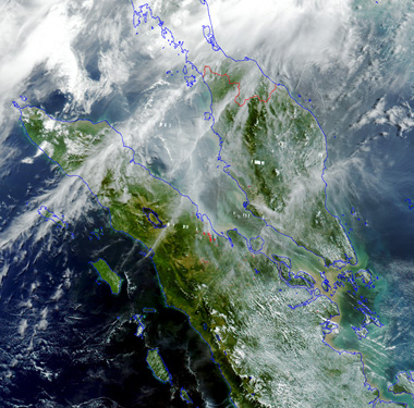
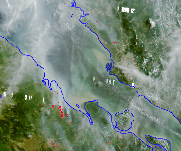
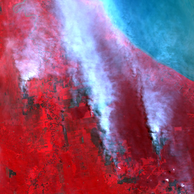
MODIS is one of the instruments on board the TERRA satellite. One of the unique features of the MODIS instrument is its ability to broadcast data from the satellite to anyone within line-of-sight. Any ground stations equipped with a 3m or larger X-band reception system and the necessary hardware and software can receive the data. The direct broadcasting mode is particularly useful for regional ground stations to perform near-real-time environmental monitoring. CRISP has carried out daily forest fire monitoring using SPOT imagery since 1997. The high resolution SPOT images were used to detect individual fires and to determine their nature in terms of the size of the smoke plumes, their locations and the landcover of the affected area. The shortcoming of using SPOT imagery for fire monitoring is that it cannot give an overview of the fires situations of the entire Southeast Asia. The conventional tool for monitoring the entire region is the NOAA-AVHRR system. However, due to its poor calibration and low saturation temperature, fires (or hotspots) detected by NOAA-AVHRR always have false alarms. MODIS has 16 thermal bands and some of these bands have a saturation level of 500K. Therefore, MODIS is well suited for hotspots detection. The algorithm to detect hotspots is similar to that of NOAA hotspot algorithm. Band 21 and band 31, which have wavelengths 3.959mm and 11.03mm, are used to determine hotspots. The criteria are BT21>360K or BT21>320K and BT21 - BT31>20K. Once a pixel is found to be hotspot, it will be marked in red
colour on the georectified MODIS image. 
MODIS Hotspot image generated on 7 Sep 2001. Smoke plumes coming out from hotspots can be seen clearly in Riau Province of Sumatra.  This is the zoom-in of Riau Province of Sumatra. The image is in 1km resolution. 
The fires captured by SPOT1 image on the same day. The resolution is 20m. |