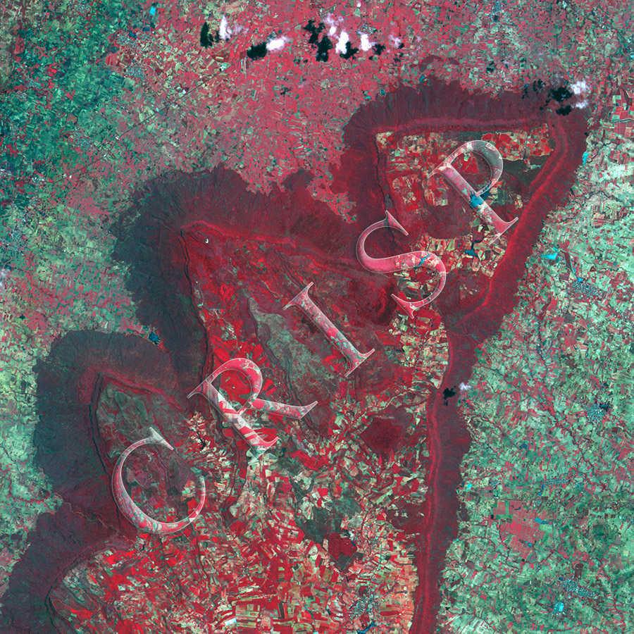
Plateau Edge North of Chaiyaphum, Thailand
2 July 2015
Note: The area of coverage in this CBERS-4 image is 24.99 km x 24.99 km.
The reduced resolution image on display has undergone compression and so does not represent the true resolution of the original satellite image.
Regional geology has made the landscape around Chaiyaphum spectacular. This is a small plateau in the north of the town, rising steeply from a surface of low relief. Low-dipping rocks have produced a landscape of near-horizontal surface bounded by steep cliffs. The near-vertical plateau edges are marked by rock shelves, intercepted by steeply-descending rivers. Narrow flat-topped ridges run on the roof of the plateau. Small rivers have their sources on top of the plateau, from where they fall steeply over the edge, in the process eroding deep valleys with steep gorges. On the lower surface, they integrate into bigger drainage forms. All the flat surfaces are well farmed, the importance of water management is indicated by the presence of a number of small reservoirs. The steeplands, especially the plateau edges, however, are densely vegetated, especially the fan deposits below the cliffs. Vegetation is in red in this falsely coloured image.