Aquaculture, Coast of South Sumatra, Indonesia
6 September 2014
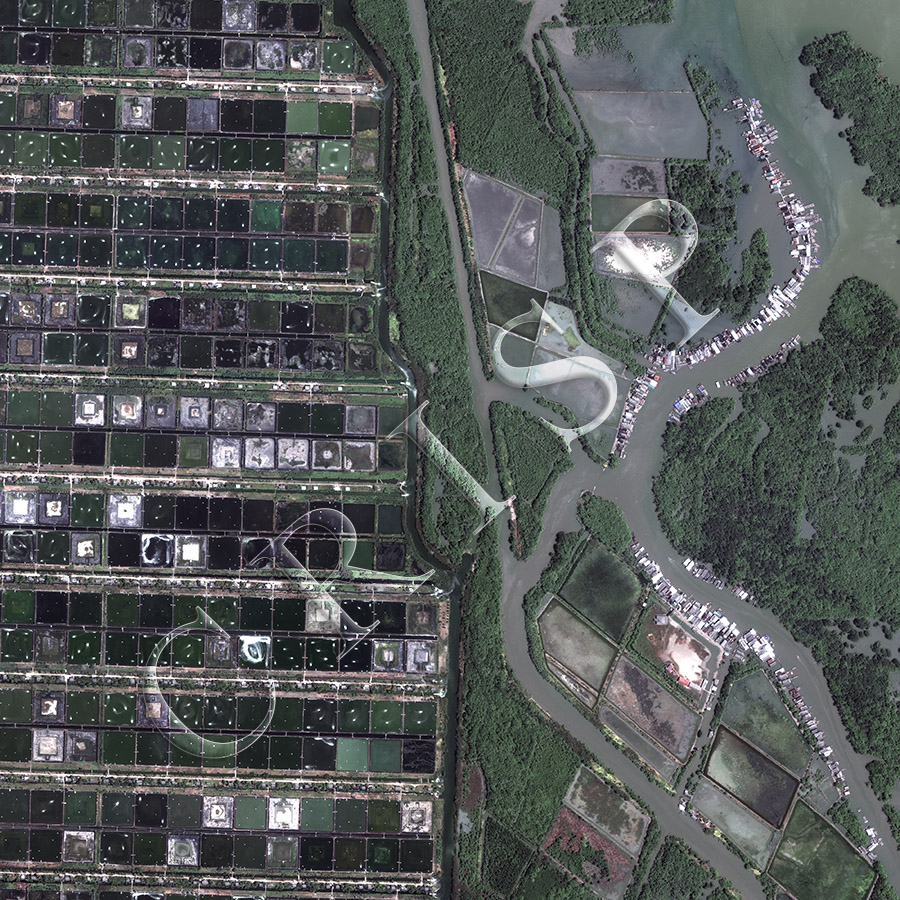
Note: The area of coverage in this WorldView-2 image is 1.90 km x 1.90 km.
The reduced resolution image on display has undergone compression and so does not represent the true resolution of the original satellite image.
This is the coast of south Sumatra, east of Lampung, which shows both the former wetland and its modification to modern aquaculture. A nearly straight north-south channel, flanked by mangrove, divides the two. East of it is the traditional coastal pattern of patches of mangrove, channels, villages on stilts flanking river banks, speedboats in the channel. Part of the wetland has been converted into large ponds for aquaculture. In contrast, in the western part of the image modern farming techniques have completely transformed the landscape. Here there are well-maintained square ponds, most likely for growing prawns. Each line of ponds is served by a canal and a road from opposite sides. The entry of water is apparently from a large boundary canal through water gates. Following this, each pond then has a controlled access to water from a smaller canal running by its side. The system obviously requires a large amount of maintenance but it is likely in future many other coasts will undergo a similar transformation.