Structurally-Controlled Landscape, Northeast India
26 January 2015
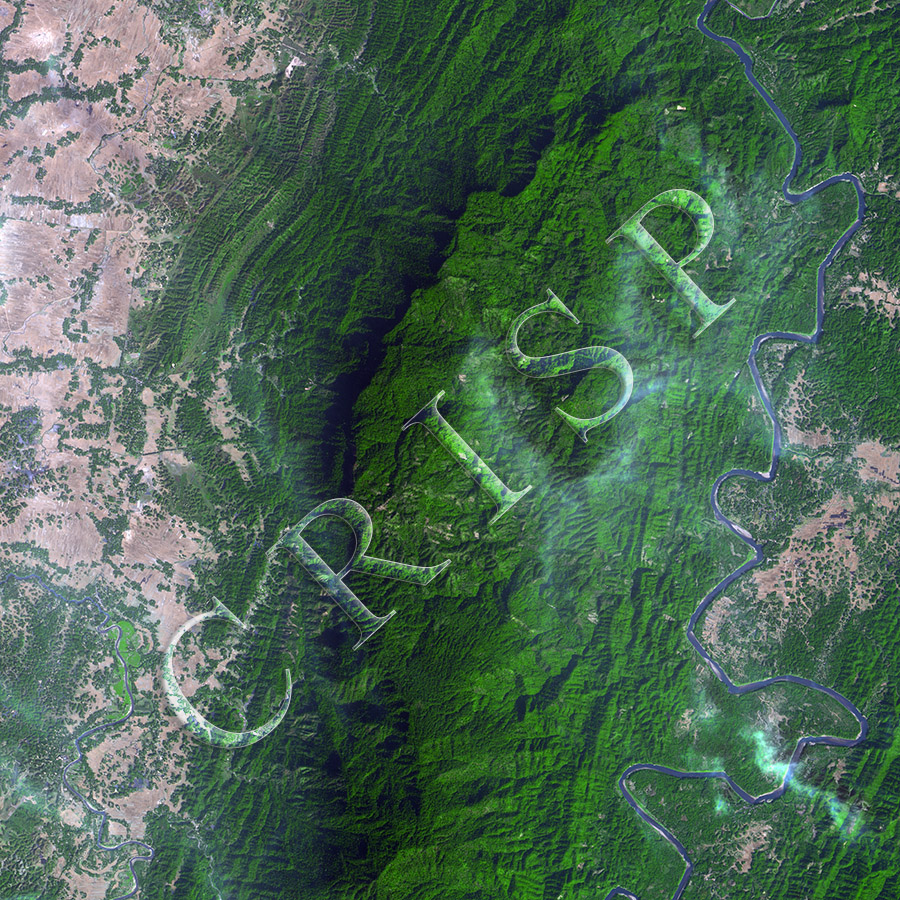
Note: The area of coverage in this SPOT-5 image is 17.498 km x 17.498 km.
The reduced resolution image on display has undergone compression and so does not represent the true resolution of the original satellite image.
In the image, structurally-controlled hills and valleys run north to south. Small ridges and valleys running perpendicular to this main trend have given a dissected appearance to most of the image, especially in the centre. Extensive low plains occur towards the northwest, where widespread cultivation has developed. By comparison, only scattered patches have been cleared on the central hillslopes, usually along small tributaries. The main valley is that of the Barak River in the east, wide enough to encourage farming at selected locations. It is a river with elongated meanders bounded by rocks in places, illustrating the effect of structure on river morphology. The exposed sand bars in the river are small, the limited supply of sediment probably indicating the protection of the extensive vegetation on steep slopes. The river, however, as shown by the colour of its water, carries considerable suspended load.