Fires Burning, Jambi, Sumatra, Indonesia
18 August 2015
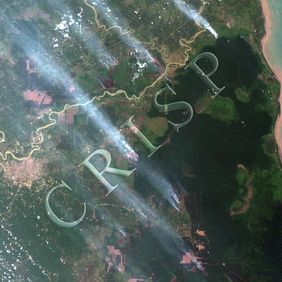
Note: The area of coverage in this CBERS-4 image is 104.56 km x 104.56 km.
The reduced resolution image on display has undergone compression and so does not represent the true resolution of the original satellite image.
These are the early fires of a long season of biomass burning in eastern Sumatra which at times create an environmental problem of massive air pollution over parts of Southeast Asia. The image stretches from the town of Jambi at the western margin to the beaches of the Strait of Malacca. The meandering river flowing to the strait is Sungai Batanghari which is joined by Sungai Berbak from the north. The settlement of Simpang grew up at the confluence, and the national park of Berbak, in dark green, is located towards the south and east. The vegetation in the park is not continuous. Deforested patches are visible inside the park and fires and burnt scars edge its sides. The smoke from a number of fire, mostly on scrublands, is drifting north and polluting the atmosphere over a populated area. The repetitive effect of this long-term biomass burning is shown by the land use mosaic: scrubland with well-marked boundaries, old burnt scars, active fires, and plantations identified by their geometric patterns.