Pujiharjo, South Coast, Java, Indonesia
12 March 2014
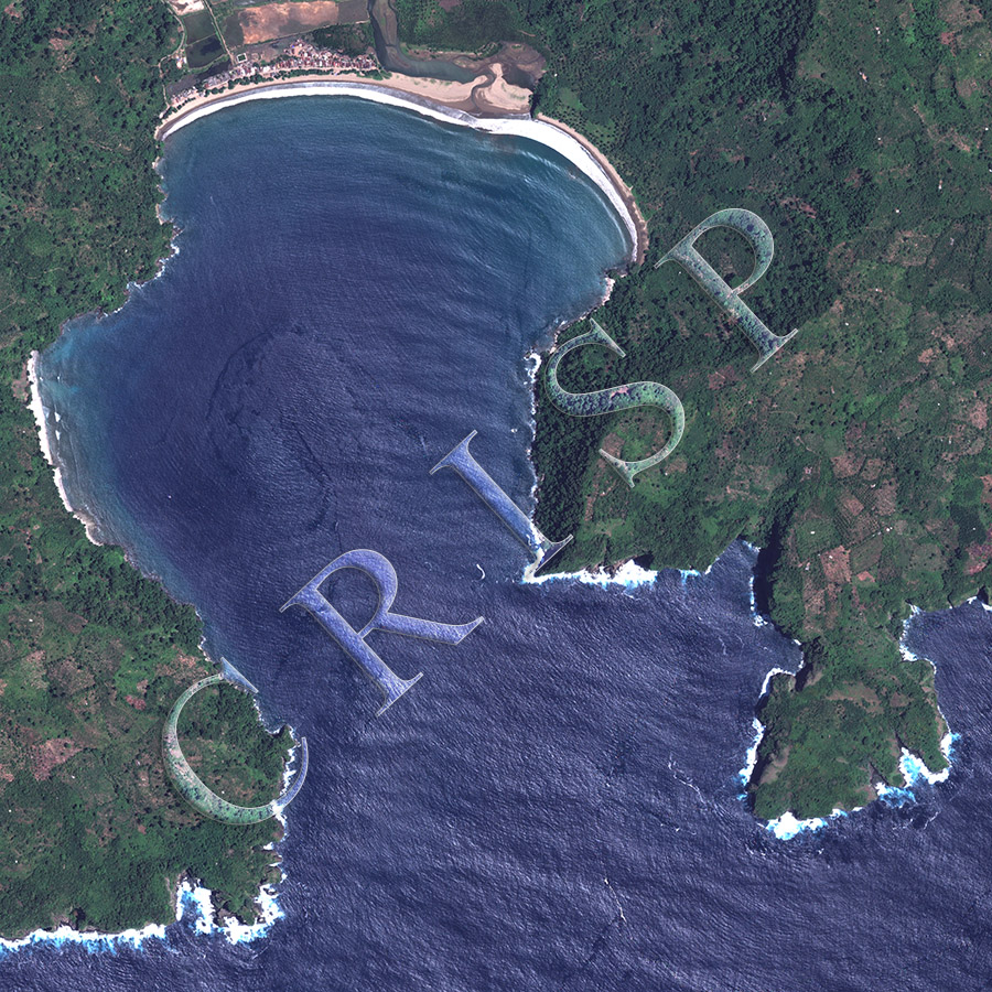
Note: The area of coverage in this WorldView-2 image is 2.75 km x 2.75 km.
The reduced resolution image on display has undergone compression and so does not represent the true resolution of the original satellite image.
South of Malang, the straight coast of south Java is scalloped into several near-circular bays with coastal villages set in the midst of spectacular scenery. The coastline is marked with strong surf, steep cliffs, and isolated, short, but well-developed beaches at bay heads. The cliffs run in short straight lines, their continuity broken by scenic headlands and surf-washed sea caves. The bay in the image is one of the eastern coves of the region, and a village with red roofs has developed behind a picturesque beach, Pantai Sipelot. The village stretches up a valley between a stream and the western hills. Two large spits, built by coastal sands at the bay head, have partially blocked the stream. Ponds for aquaculture have been built in the flat valley, but elsewhere, the slopes of the headlands are patchily farmed, leaving the steeper sections under large trees. Coconut Palms and banana trees are seen near the village.