Delta of the Po River, Italy
16 April 2014
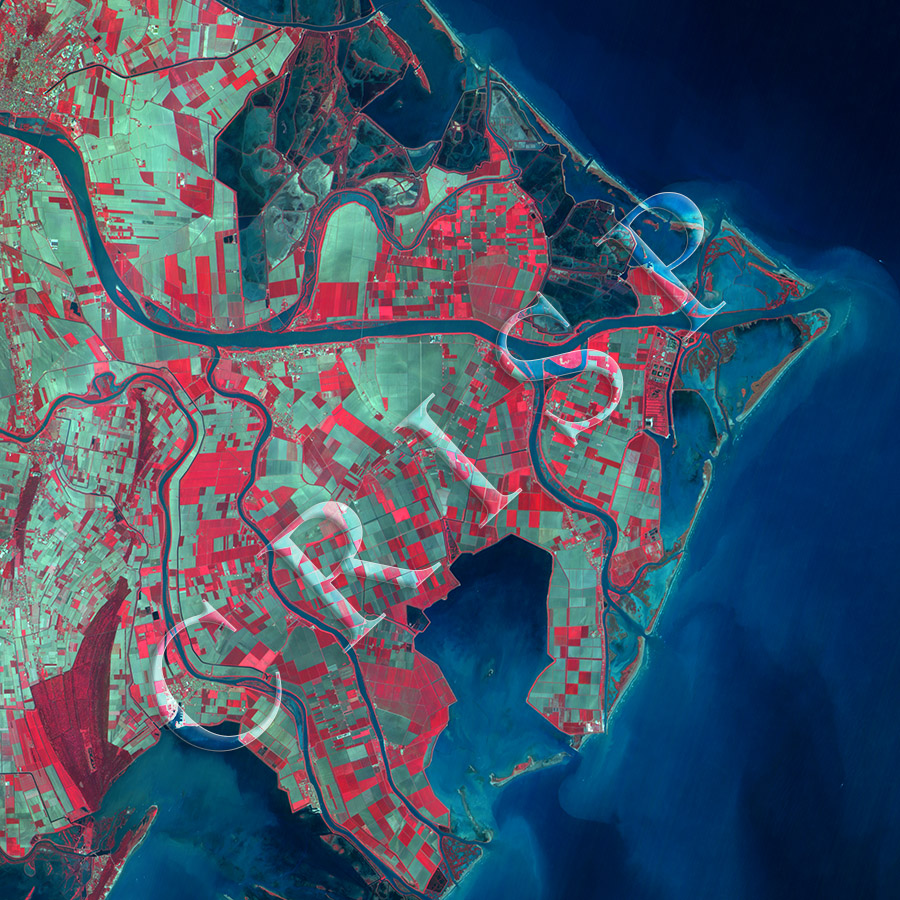
Note: The area of coverage in this XSAT image is 28.99 km x 28.99 km.
The reduced resolution image on display has undergone compression and so does not represent the true resolution of the original satellite image.
The sediment–laden delta of the Po River is extending into the Adriatic Sea. A number of spits, bars, backswamps, and bays mark the outer edge of this river-dominated delta. These are backed by several distributaries, which are controlled by embankments throughout the main body of the delta. Small islands, the higher parts of which are vegetated, occur inside several of these distributaries. The flat delta is intensively farmed; vegetation is in red in the XSat image. Almost the entire delta is covered by geometric agricultural fields of a wide range of sizes, about half of which are in crops. The fields elongate in the southwestern part of the image, suggesting modified stream channels. Scattered settlements are visible, including the eastern edge of Porto Tolle towards the west of the area.