Bridges of a Deltaic City, Ho Chi Minh City, Viet Nam
9 February 2014
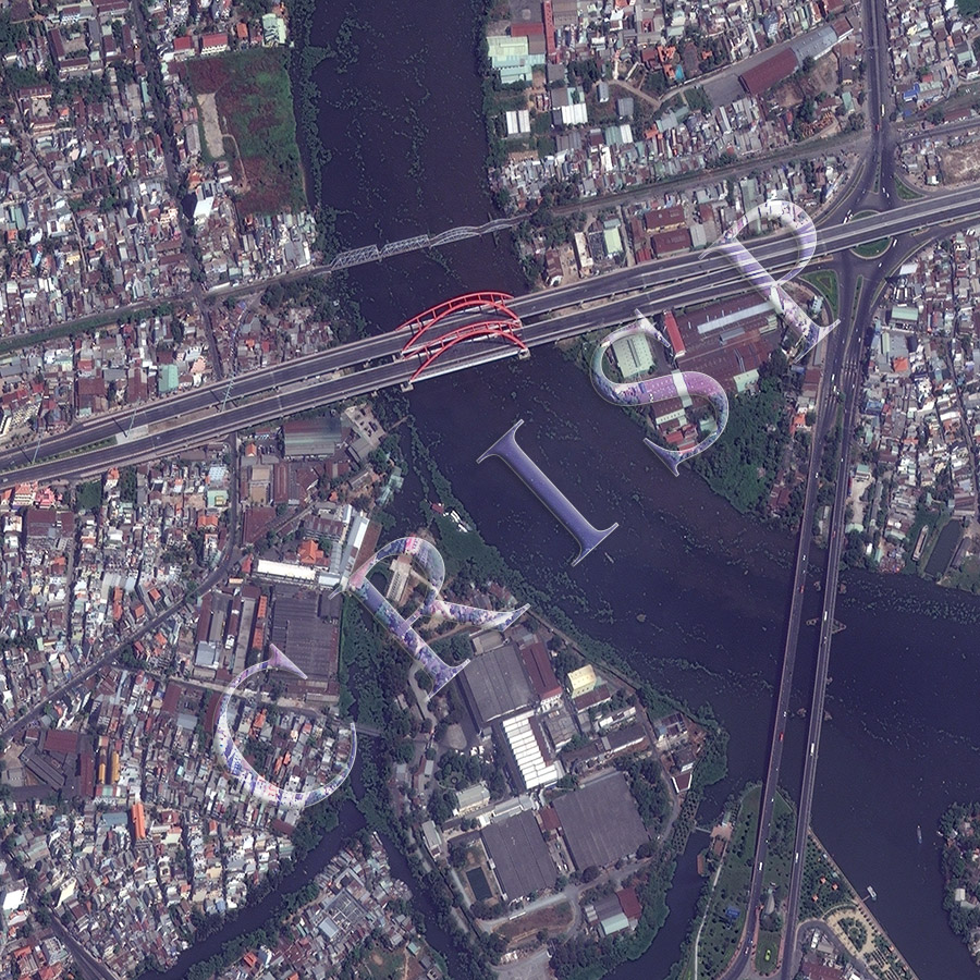
Note: The area of coverage in this WorldView-2 image is 1.20 km x 1.20 km.
The reduced resolution image on display has undergone compression and so does not represent the true resolution of the original satellite image.
This is part of Ho Chi Minh City, east of the airport, illustrating the infrastructure of a major city developed at the edge of a major delta. The winding Saigon River flows north to south under large bridges, past isolated and fragmented wetlands. Most of the image shows a low-lying city, of small, low buildings, but in places these buildings are being replaced by larger, higher structures. This is an area of mixed land use with buildings for residential, administrative, and business purposes. Several large bridges carry highways and rail tracks across the river. The striking red arches of Cau Binh Loi road bridge are at the centre of the image with a rail bridge immediately upstream. The river is crossed also near the eastern margin of the image by the separated lines of Cau Binh Triau road bridge, allowing a junction with the traffic coming along the road below the red arches.