Urban Development, Sandakan, Sabah, East Malaysia
20 August 2012
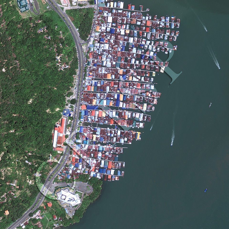
Note: The area of coverage in this GeoEye-1 image is 1.00 km x 1.00 km.
The reduced resolution image on display has undergone compression and so does not represent the true resolution of the original satellite image.
The water village of Sim Sim is along the coast, northeast of Sandakan in Sabah, East Malaysia. A tree-clad hill slope flanks the coast, skirted by the multiple lane, divided highway of Jalan Buli Sim Sim. The area is undergoing development, as demonstrated by the large new mosque and other institutional buildings next to the road. Scattered construction plots and small landslides break through the forest canopy. The water village, which stretches for about half-a-kilometer over water on stilts, has houses with wooden floors and colourful metal roofs. Several fast boats are out in the sea and a number of residents’ boats are anchored in narrow passages between the houses. The narrow sides of the houses face footpaths which allow approach from both land and water. The image is a fascinating assemblage of modern car-based land development and traditional connections over water.