Open-Cast Mining, South Sumatra, Indonesia
10 September 2012
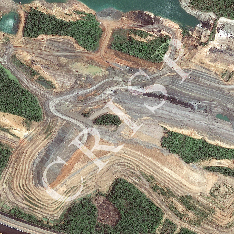
Note: The area of coverage in this GeoEye-1 image is 0.78 km x 0.78 km.
The reduced resolution image on display has undergone compression and so does not represent the true resolution of the original satellite image.
This is a high-resolution image of open-cast coal mining near Lahat, south Sumatra. The coal is derived from a Tertiary basin, east of the Barisan Mountains. The image shows deep pits, narrow descending passages, and wider roads with active mining trucks. Excavators and many trucks can be seen loading coal at the bottom of various excavations. Both the dark coal and the reddish-brown overburden can clearly be seen in the excavated basins, and so can the areas where the ground has been covered with the dumping of the overburden after removal. The amount of excavation is demonstrated by the higher remnant land left in geometric shapes between excavations, often under dense trees. The time-sequence and the pattern of open-cast mining are clearly demonstrated.