Eruption of Gunung Sinabung, North Sumatra, Indonesia
11 February 2014
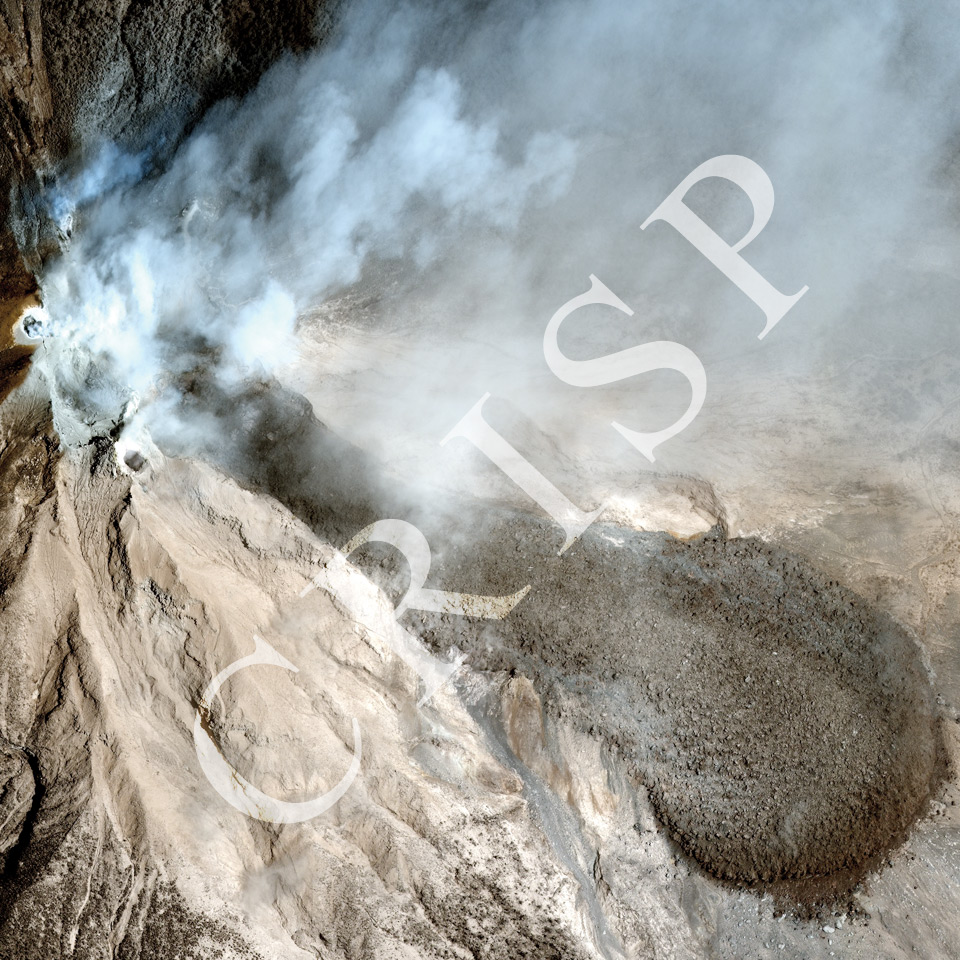
Note: The area of coverage in this WorldView-2 image is 1.75 km x 1.75 km.
The reduced resolution image on display has undergone compression and so does not represent the true resolution of the original satellite image.
Gunung (Mount) Sinabung is a 2460 m high, Pleistocene-Holocene andesite and dacite stratovolcano in the Karo Plateau of north Sumatra, near the town of Kabanjahe, 25 km northwest of Lake Toba. A series of eruptions began in 2010, the first since 1600. The image displays part of the effect of the eruption of 1 February 2014, with ash clouds, ash flows, pyroclastic flows, and lava flows. Several people were killed near the volcano. Subsequent eruptions took place in July. The image displays a series of small craters towards the northwest with smoke rising from them, and a large tongue of lava running southeast, diagonally across the image. The lava, which has steep sides, sits on top of earlier ash and pyroclastic flows. Radial openings characterise the end of the flow along with coarse material scattered across the generally finer surface. The eruption destroyed the vegetation on the southeastern slope of the volcano.