Istanbul and The Bosporus
18 February 2014
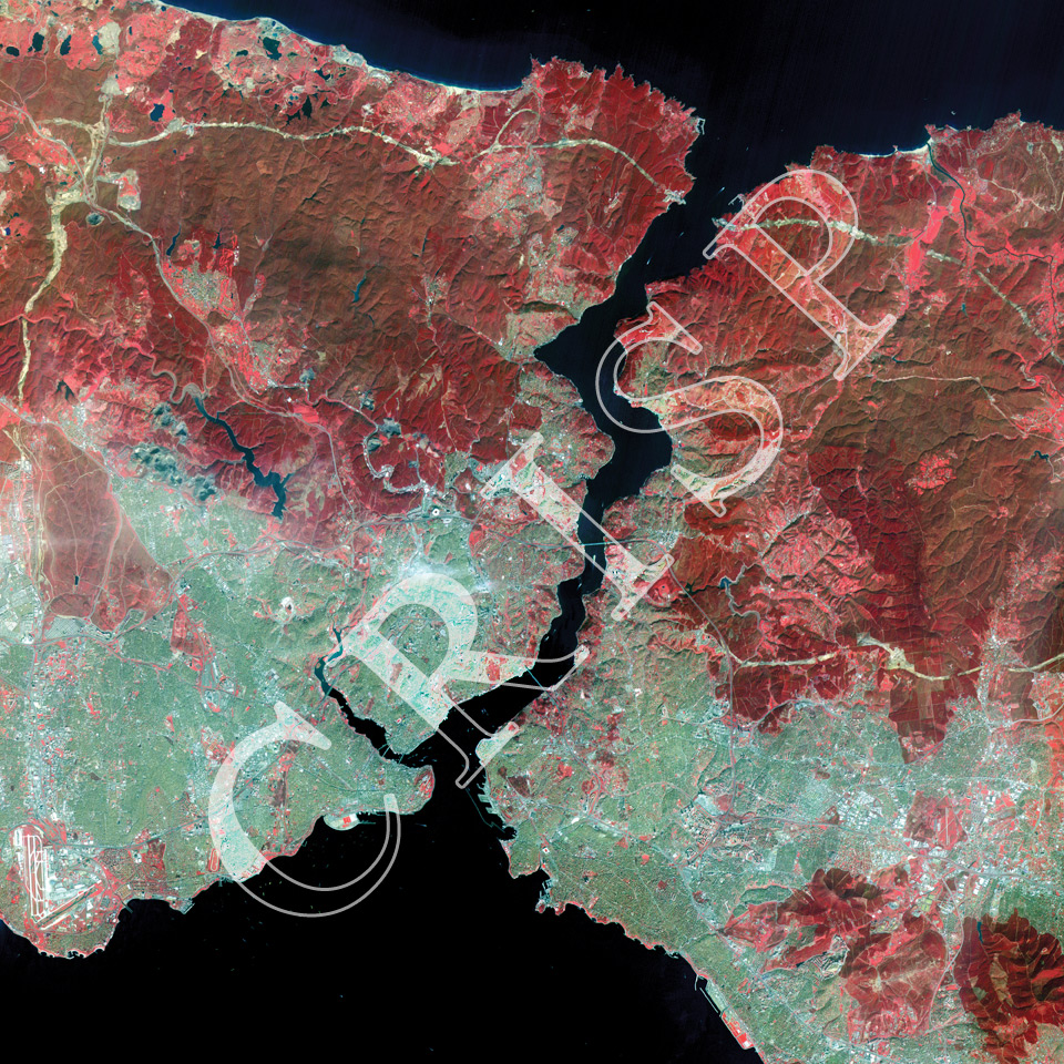
Note: The area of coverage in this XSAT image is 40.00 km x 40.00 km.
The reduced resolution image on display has undergone compression and so does not represent the true resolution of the original satellite image.
The image is centred on the Bosporus, which joins the Black Sea to the north with the Sea of Marmara to the south. Boats of various size are crossing the Bosporus. The city of Istanbul is to the south of the image, the European part to the west and the Asian part to the east of the strait. The winding waterway branching towards the northwest under a series of bridges, is the Golden Horn. Between the Golden Horn and the Sea of Marmara is the Sultanahmet area of the city. This is where the famous historical structures of the city are located, including Hagia Sophia from the 6th century, the Topkapi Palace, the Blue Mosque, the Great Bazaar. Further west, near the edge of the image, is the large Ataturk airport. The Asian side of Istanbul, especially near the coast, is densely settled. Two large bridges, the Bosporus and Galetta, cross the Bosporus, connecting the two sides of the city. Towards the north, beyond the main city of Istanbul, the land is hilly under different types of vegetation which show up red on this falsely-coloured image.