Land Use In Coastal Swamps, Northeast Aceh, Sumatra, Indonesia
19 January 2013
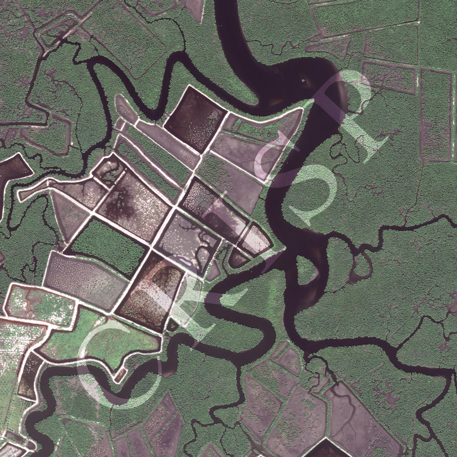
Note: The area of coverage in this WorldView-2 image is 1.53 km x 1.53 km.
The reduced resolution image on display has undergone compression and so does not represent the true resolution of the original satellite image.
The coastal swamps of northeast Aceh facing the Strait of Malacca are being drained and reclaimed for economic utilization. The image is a spectacular mosaic in several colours of black water channels, green mangrove, swamp vegetation, and geometric land use. The image displays the sequence of land preparation in this coastal wetland: marking out of plots, construction of embankments along the markings, clearing of vegetation, draining of the plots. The southwestern corner of the image shows the next stage. The reclaimed land has been subdivided and young trees planted, but not many. The return of young mangrove plants in some of these plots suggests that plots may be abandoned, at least temporarily.