An Erupting Volcano, Pulau Palu, Indonesia
21 August 2013
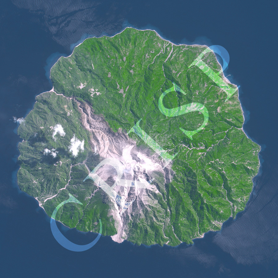
Note: The area of coverage in this SPOT-5 image is 8.75 km x 8.75 km.
The reduced resolution image on display has undergone compression and so does not represent the true resolution of the original satellite image.
The SPOT 5 satellite captured an erupting volcano on a small island in the eastern Nusa Tenggara. The island of Palu, the upper part of a stratovolcano that has risen above the sea level, is located in the Flores Sea, off the north coast of Flores. This pyroclastic eruption of late August 2013 shows incandescent material near the crater and four pyroclastic flows descending down the volcanic slopes. These flows have reached the sea to form coastal fans. The main pyroclastic flow travelled directly south while a smaller one reached the sea through a gorge towards the northwest. The third used a narrow steep valley towards the southwest while the fourth and the smallest flowed due east. Occurrences of similar pyroclastic flows in the past are evident round the flanks of the volcano. Coarse pyroclastic material, up to the size of boulders, lie scattered on the upper slopes, below the crater whose rim is indistinctly visible through the burning material being erupted.