Marseilles and The Mediterranean, France
4 August 2013
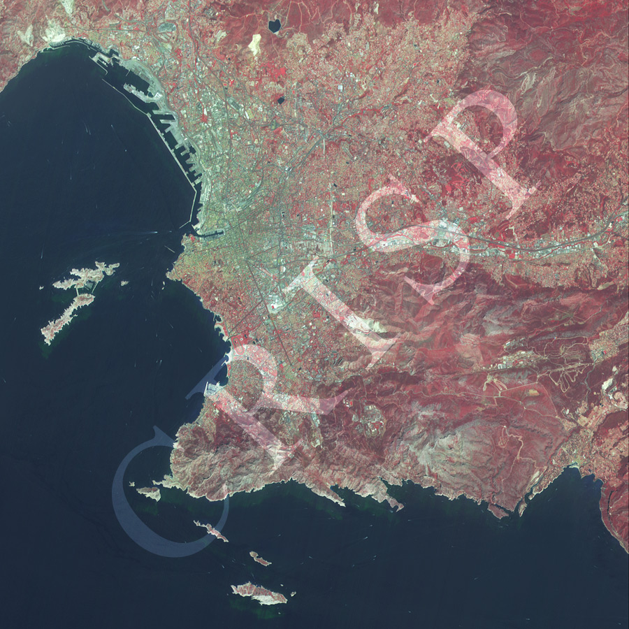
Note: The area of coverage in this XSAT image is 24 km x 24 km.
The reduced resolution image on display has undergone compression and so does not represent the true resolution of the original satellite image.
The port of Marseilles, the surrounding hills, and the Mediterranean Sea appear in the XSAT image in false colour (vegetation in red). The modern port area is clearly visible behind a long line of breakwater. The old port (Vieux Port), where Marseilles started as a Greek harbour on the western Mediterranean, is the bay form indentation, immediately to the south of the current port. The well known thoroughfare of Marseilles, La Canebière, extends northeast from the head of the indentation. North of the Vieux Port is the densely packed area of Le Panier, the former market place of Marseilles. The Basilique Notre Dame, can be seen a little south of the old port, but not clearly. In contrast, the large sporting area of the Hippodrome, located immediately inland of the southern bay area with protective engineering structures, is distinctly visible. The major arterial road, Route A50, heads east out of Marseilles into the surrounding steep hills and beyond.