Doha and Coast, Qatar
5 January 2013
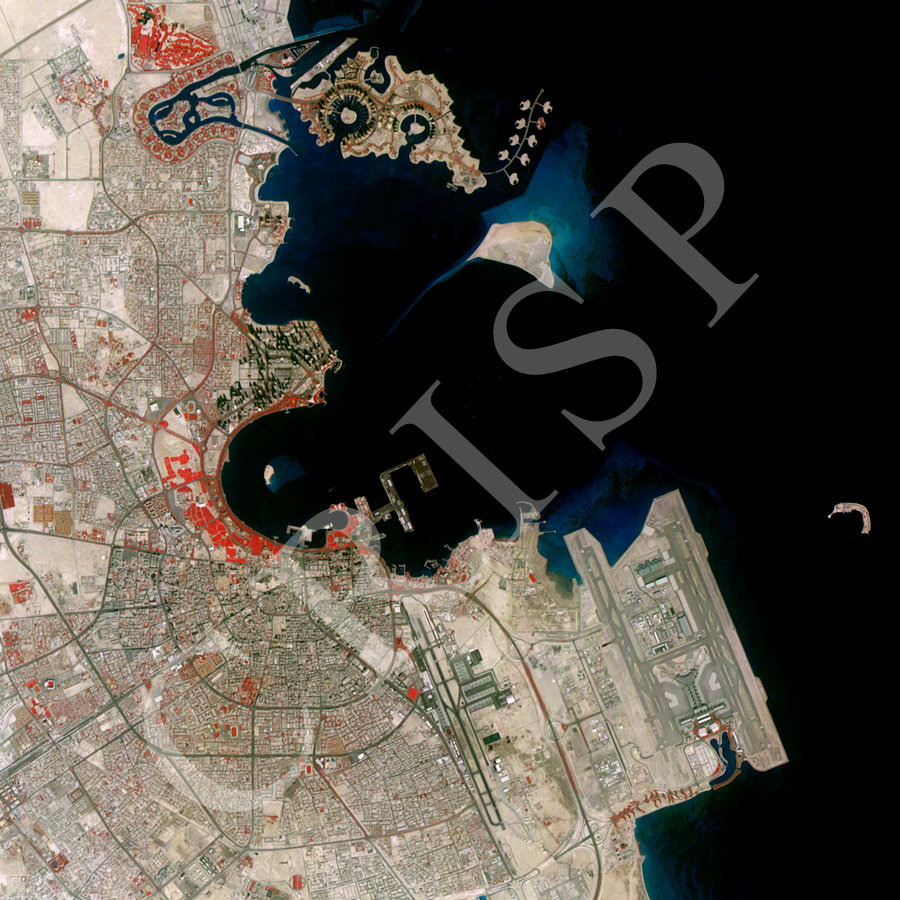
Note: The area of coverage in this XSAT image is 18 km x 18 km.
The reduced resolution image on display has undergone compression and so does not represent the true resolution of the original satellite image.
The XSAT image in false colour (Vegetation in red) covers part of Doha and the coastline. Towards north is the reclaimed island of the Pearl Qatar with its intricate coastline, a line of small islands, and spectacular buildings. In the centre of the image is the Qatar Port with docking facilities. An extensive area of green space (in red) joins the dock area to the mainland. The Museum of Islamic Art is next to this green space. More green space occurs along the bay head, along the wide avenue of Al Corniche backed by a modern city of ring roads, spectacular buildings, and market places such as Souk Wafid. A number of sports fields show up in the image due to their distinctiveness. Towards the south, the Doha Airport, with its multiple runways and large terminal buildings, spreads out over a very large area of reclaimed land.