The Mekong Delta, Ca Mau Province, Vietnam
26 June 2013
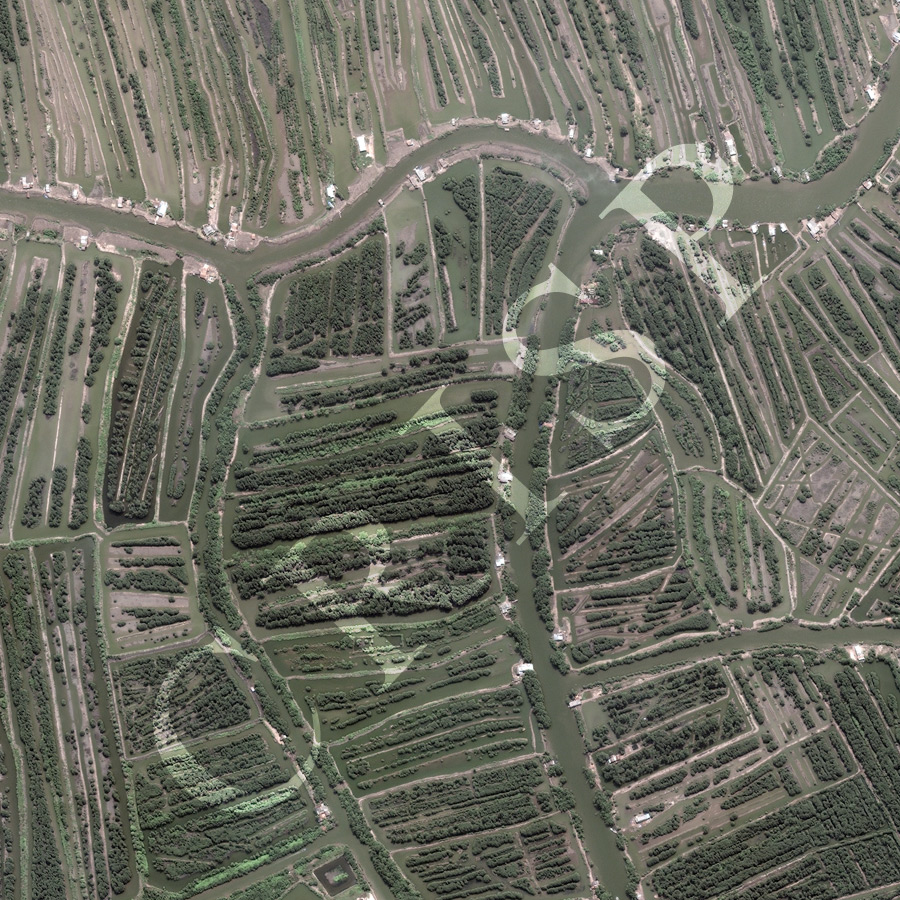
Note: The area of coverage in this WorldView-2 image is 1.25 km x 1.25 km.
The reduced resolution image on display has undergone compression and so does not represent the true resolution of the original satellite image.
This is a remarkable example of anthropogenic alteration of the land. The scene illustrates part of the Ca Mau region of the Mekong Delta; the South China Sea is several kilometers beyond the southern margin of the image. This is a watery landscape, levees providing the only high ground along the streams. All the houses are on levees, a number with piers for boats as communication is almost entirely by water. The backswamps between the levee-bounded streams have been converted by incredible human effort into parallel strips of high ground and channels, with mangrove on high grounds and prawn farming in the channels. A unique geometric landscape has developed in a muddy delta, where apparently the only natural features left are the bigger stream channels with their mudbanks and silt bars.