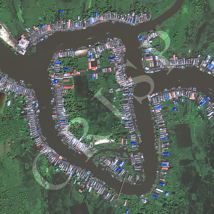
River Bank Village, West Kalimantan, Indonesia
8 January 2012
Note: The area of coverage in this GeoEye-1 image is 0.975 km x 0.975 km.
The reduced resolution image on display has undergone compression and so does not represent the true resolution of the original satellite image.
The village is located on the headwaters of the Mahakam River in Kalimantan. Two rivers meet and flow towards the east after circumventing an island. The village has grown up on the levees of both rivers, utilizing the high places in a low wetland. The geometric pattern of this village of bright sloping roofs is also determined by the practice of every house being built with its shorter side facing the water, thus providing each household with its own passage to a river, the main transportation system. This results in riverbanks being bordered with a one-house wide strip. Households seem to have their own piers and at least one boat each. Several boats with outboard motors are in the two rivers, moving at a rapid pace. Short passages on land are accomplished on boardwalks raised over extensive swamps. Groves of large trees, denser near the houses, grow in the swamp. A large mosque oversees the downstream exit from the image.