Lake Meade and Las Vegas, Southwestern United States
1 August 2013
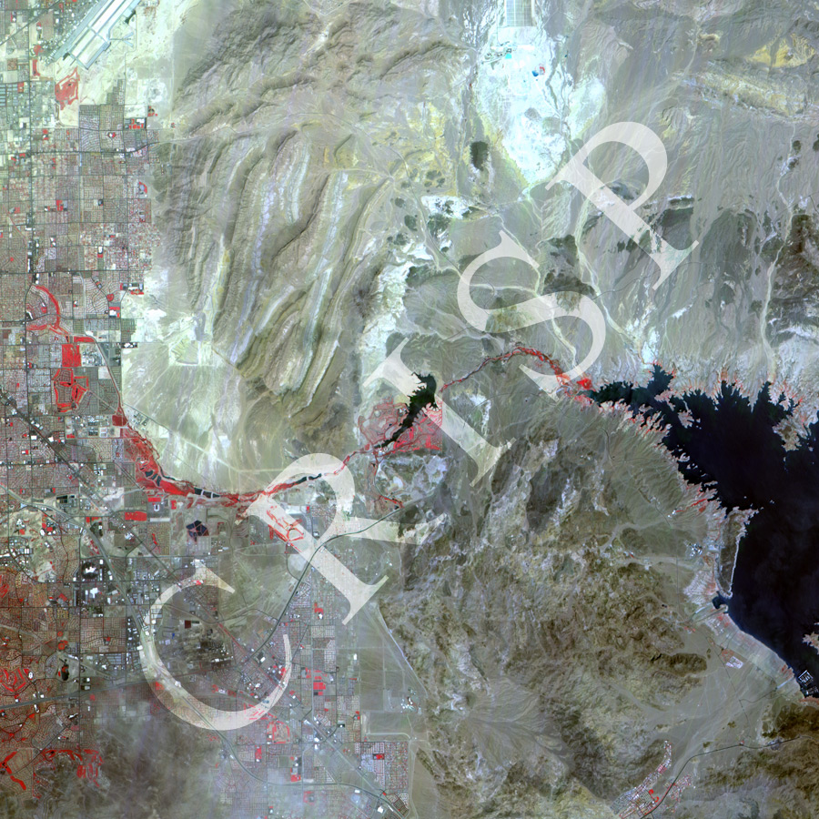
Note: The area of coverage in this XSAT image is 28 km x 28 km.
The reduced resolution image on display has undergone compression and so does not represent the true resolution of the original satellite image.
The XSAT image in false colour (vegetation in red) shows the arid landscape of Arizona and Nevada in the southwestern United States. Lake Mead, the reservoir behind Hoover Dam, is towards the eastern margin. Part of the dam could be seen next to the margin. The city of Las Vegas with its rectangular grid pattern, wide streets, huge structures, and scattered green spaces dominate the western part. A line of green space (in red on the image) occurs by the other reservoir, Lake Las Vegas, and continues along the waterway connecting it to the city. The other major feature on the image is the dry rocky landscape between Las Vegas and Lake Mead that stretches to the north and northeast. The Nevada Desert, an extreme example in aridity, lies on the northeastern corner, its aridity indicated by the brightness of its surface. Dry drainage lines of regional arroyos slope towards Lake Mead from the arid northeast.