Arid Landscape, Upper Finke River, Australia
25 July 2013
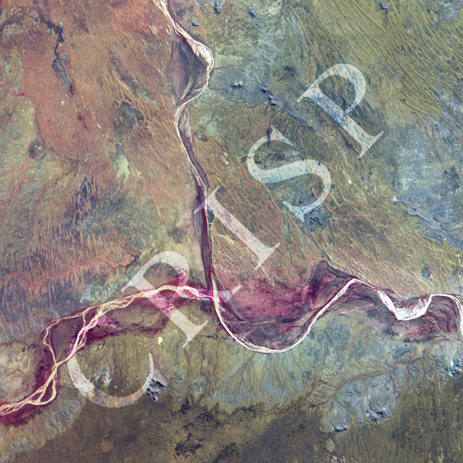
Note: The area of coverage in this XSAT image is 23.99 km x 23.99 km.
The reduced resolution image on display has undergone compression and so does not represent the true resolution of the original satellite image.
The Finke runs north-south through the middle of an extremely arid landscape of central Australia, southeast of Alice Springs. It is joined by a major tributary from the west, and the combined channel turns east towards the Simpson Desert. Dry channels of a number of smaller streams join these two rivers from the south. These rivers carry water only after episodic and intense rainfall. Their dry wide channels carry evidences of past floods, such floods determining the dimensions of these rivers. Steps and terraces, various bar forms, and anabranching patterns are found in these channels. Vegetation is red in this false-colour image, and seen only on riverbanks. Trees grow on river beds, where their root systems may reach moisture even in the dry period. Elsewhere, a mosaic of bare rocks and sand dunes form a red, brow and yellow landscape. The dunes are of various types: linear, crescentic ridge, parabolic.