Part of The Crater of Mount Rinjani, Lombok, Indonesia
26 June 2012
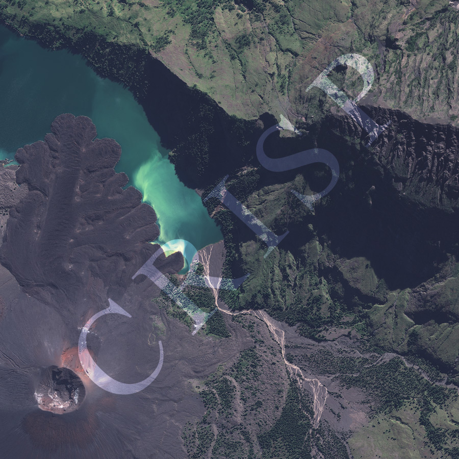
Note: The area of coverage in this GEOEYE-1 image is approximately 2.5 km x 2.5 km.
The reduced resolution image on display has undergone compression and so does not represent the true resolution of the original satellite image.
The image shows part of the huge volcanic complex of Rinjani, which dominates the northern part of the island of Lombok, the second highest volcano of Indonesia, at 3726 m. Its crater carries a blue-green lake, Danau Segara Anak (the Child of the Sea). Part of the lake is visible in the image as well as several hot springs. About two hundred years ago, a new cone, emerged from the middle of the lake. It is visible in the image, with its lower slopes tinged red, along with a pyroclastic flow that has travelled northwards into the lake. The inner slopes of the crater show a variety of landscapes: tree-covered slopes; hardened bare pyroclastic flows; pioneering low vegetation; streams draining from rim of the crater to the lake across the volcanic material, which build fans on the lake shore. Boulders of volcanic material erupted by the Rinjani lie scattered over the upper slopes.