The Mekong River, Southern Lao PDR
7 January 2012
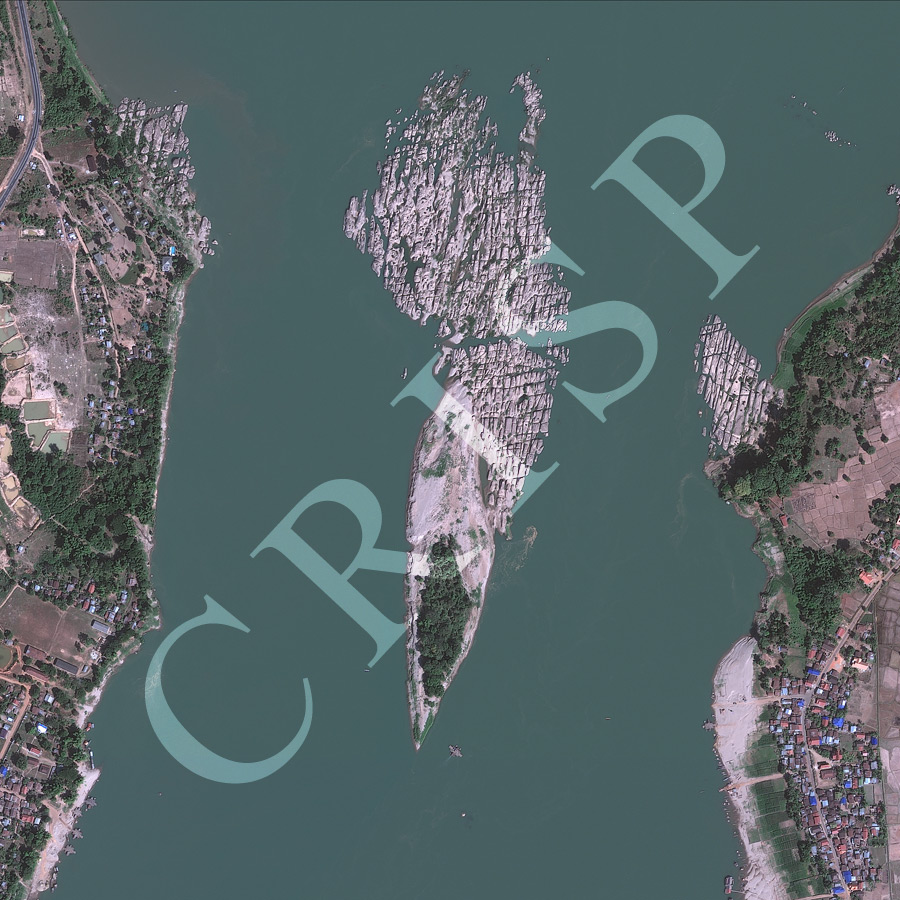
Note: The area of coverage in this GEOEYE-1 image is approximately 1.5 km x 1.5 km.
The reduced resolution image on display has undergone compression and so does not represent the true resolution of the original satellite image.
This is the archetypical Mekong River of the southern Lao PDR from the Champasak area. The image is located 30 km south of Pakse, immediately to the north of the large island of Don Daeng. The Mekong has eroded its entire channel cutting into sedimentary rocks, using the lineations clearly seen in the image. These structural lines of weakness have divided the rock surface into innumerable little mounds separated by hollows, which are currently under water. A few trees have established themselves on the higher points of the rock surface. The island in the centre of the image has been built by the south-flowing Mekong by depositing sand in the lee of rocks. The banks of the downstream part of the island are marked by lines showing elevations of past floods. The downstream tip of the island carries a grove of large trees indicating that it is rarely submerged. Away from the river paddy fields, scattered houses alternating with groves of trees, and a number of boat piers characterize the local landscape.