Rosario On The Paraná, Argentina
31 December 2011
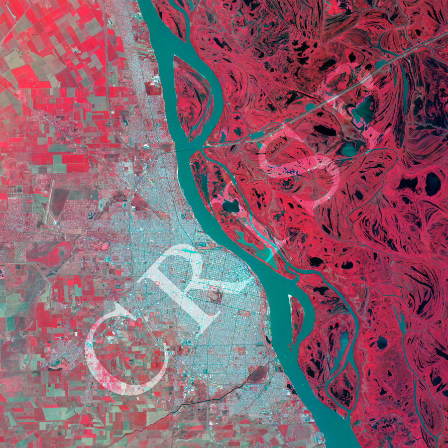
Note: The area of coverage in this XSAT image is approximately 32 km x 32 km.
The reduced resolution image on display has undergone compression and so does not represent the true resolution of the original satellite image.
The city of Rosario grew up on the west bank of the Paraná River in southeastern Argentina. The low flat east bank of the Paraná is a swampy mosaic of abandoned channels, mobile distributaries, and waterbodies of various sizes. In contrast, the west bank carries a well planned grid-iron city, bounded by highways and backed by wheat fields. Rosario is an important inland port through which farm products and goods related to agro-industry pass down the river. The Rosario-Victoria Bridge over the river connects the city to the east by land. North of the bridge the compact elliptical pattern of the city becomes a linear belt between the wheat fields and the river. The city architecture is not clearly visible in the 10 m resolution of the XSat, but even then the large open space in the middle with a sports stadium, parks, and several monumental buildings is conspicuous. So is the airport towards the northwest of the city. It is a city known for industry, culture and sports. The image is in false colour, vegetation red.