The Cityscape of Dubai, United Arab Emirates
20 August 2012
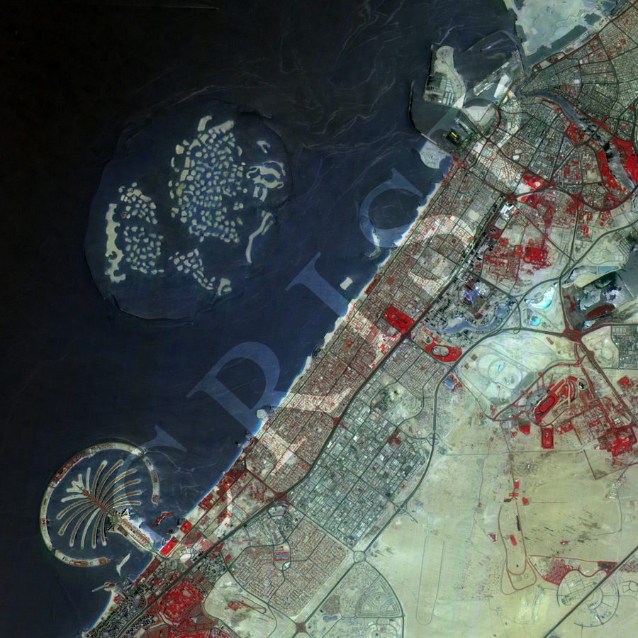
Note: The area of coverage in this XSAT image is approximately 25 km x 25 km.
The reduced resolution image on display has undergone compression and so does not represent the true resolution of the original satellite image.
Dubai lies on the western coast of the Persian Gulf, stretching over the sandy part of the Arabian Desert. The XSat image shows part of the city, including the Palm Jumeirah, one of the three artificial archipelagoes of Dubai, towards the southwestern corner. North of the Palm Jumeirah, the World Islands archipelago, roughly resembling a world map, lies offshore and is under construction. A well-planned road network and large buildings are clearly visible, indicating the role of Dubai as a centre for finance, tourism, and real estate. Numerous recreation centres are visible, especially near the coast. The coastline has been transformed by extensive engineering. The image is in false colour, highlighting the vegetated spaces in the middle of this city in the desert.