The Great Food of 2011, Central Plain, Thailand
26 October 2011
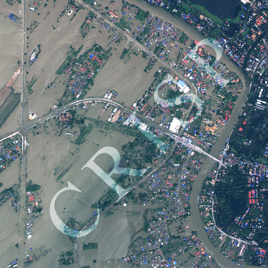
Note: The area of coverage in this Worldview-2 image is approximately 2.5 km x 2.5 km.
The reduced resolution image on display has undergone compression and so does not represent the true resolution of the original satellite image.
In 2011, an extensive and long-duration flood came down the Chao Phraya to submerge the Central Plain of Thailand and the city of Bangkok. The image displays widespread inundation of low and flat land near Ayutthaya. Highways and paddy fields were submerged, and houses became isolated in a vast stretch of sediment-laden water flowing south. The geometry of submerged vegetation, road systems, and settlements controlled the flow of shallow floodwater and the passage of sediment. The Wat Kasatthirat Bridge functioned as a safe car park, high above the floodwater. The golden building immediately upstream of the bridge, on the west bank of the river, is the partly inundated Wat Kasatthirat. Many other temples and important sites were flooded, such as, Wat Chai Wattanaram, in the southeastern corner of the image, easily spotted as the set of golden buildings in the middle of flooded grounds. Here the Chao Phraya overflowed its western embankment.