Upper Brahmaputra Near Pasighat, India
12 March 2012
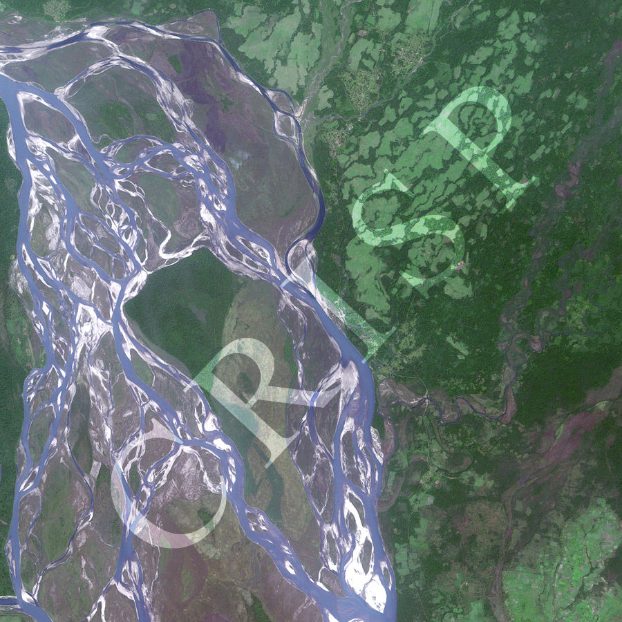
Note: The area of coverage in this SPOT-5 image is approximately 15 km x 15 km.
The reduced resolution image on display has undergone compression and so does not represent the true resolution of the original satellite image.
The river in the image is the Siang, one of the major headwaters of the Brahmaputra River, near the town of Pasighat in northeastern India. Descending from the Himalaya Mountains, this extremely turbulent river flows fast over a very steep gradient. This is an area of very heavy monsoon rainfall. The river consequently has a wide braided channel with bars at various levels, indicating past floods, seasonality in discharge, and a high sediment load. In this dry-season image, the flood history of the river is indicated by the distribution of multiple channels of different widths, low sand bars, brown bar tops, scrub vegetation and small trees on the higher bars. A tremendous volume of sand is stored in the channel, most of which will be transported downstream in the next high flow. A striking mosaic of different colours across the image is created by vegetation of different shades of green on the slopes, dry brown beds of tributary rivers, and the variegated hues of the wide channel of the Siang.