Land Use Change, Kayan Delta, East Kalimantan, Indonesia
31 July 2012
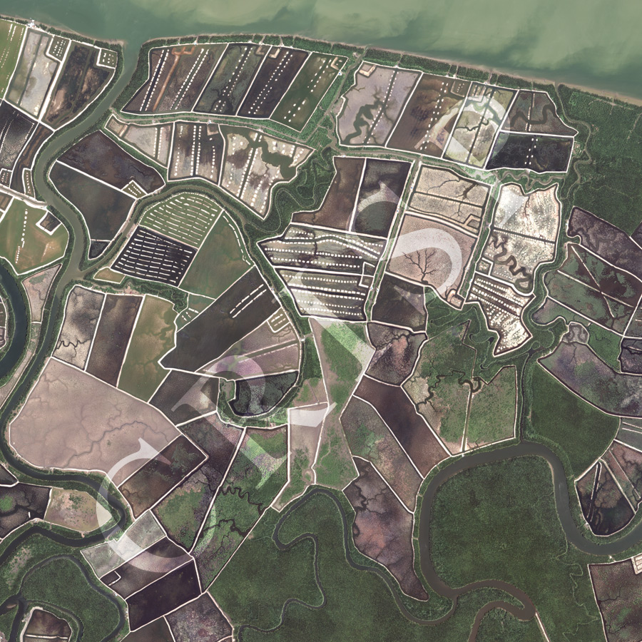
Note: The area of coverage in this WorldView-2 image is approximately 4 km x 4 km.
The reduced resolution image on display has undergone compression and so does not represent the true resolution of the original satellite image.
Large-scale changes are happening in the delta of the Kayan, a major river of east Kalimantan, which opens into the Sulawesi Sea. The original pattern of tidal creeks and mangroves is being altered to ponds for aquaculture. The image is a mosaic of embankment-bounded ponds, showing a gradation of development, north to south. Towards the north, ponds next to a major tidal distributary of the Kayan are already drained of brackish water and function as fish and prawn ponds. In the centre of the image, the majority of the ponds are being drained but still display the channels of the original tidal creeks eroded into a flat, near-dry surface. Embankments surround larger ones further inland, which still carry the mangroves and tidal creeks that earlier formed the coastal landscape. The tidal creeks remain connected with each other, draining into a major river channel towards the north.