River Segama Through The Lowland Forest, Sabah, Malaysia
9 December 2011
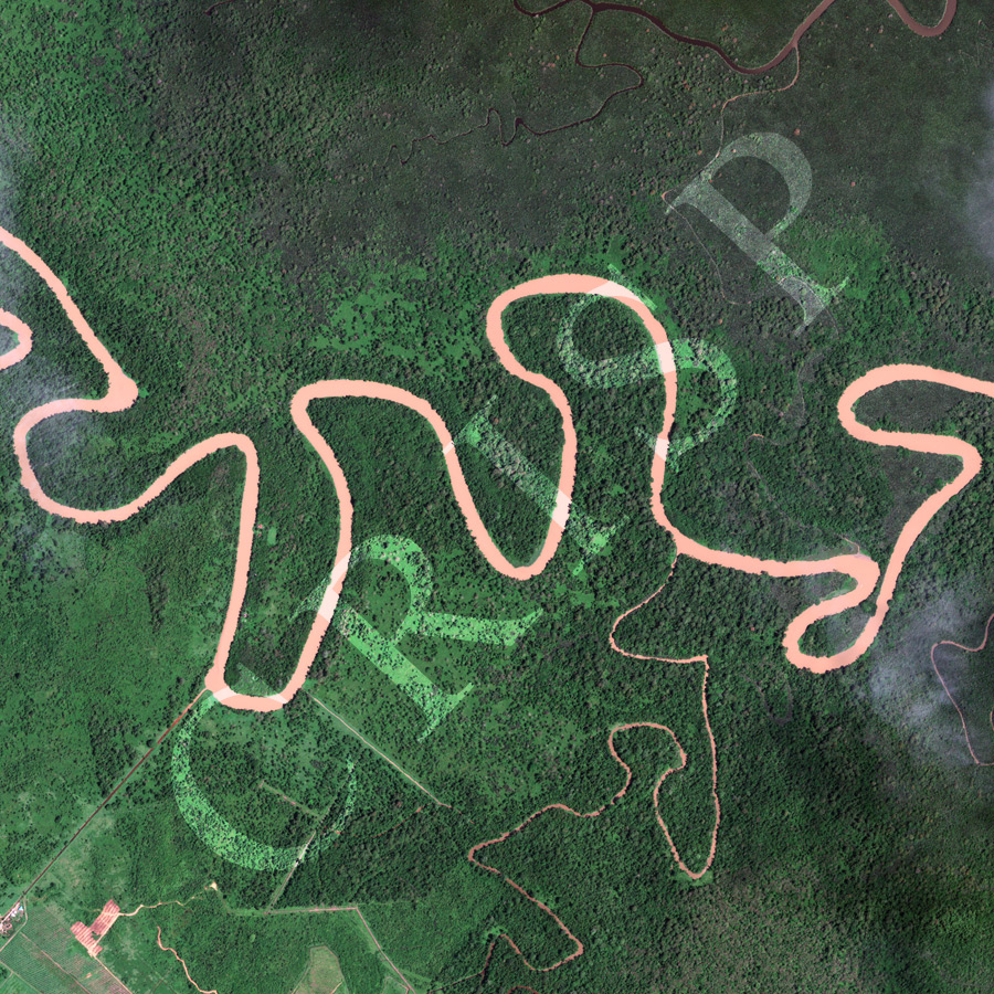
Note: The area of coverage in this GeoEye-1 image is approximately 5.2 km x 5.2 km.
The reduced resolution image on display has undergone compression and so does not represent the true resolution of the original satellite image.
The lower part of the Segama River meanders through the lowlands of east Sabah before flowing into the Sulu Sea. The Segama rises in the Brassey Ranges to the west and flows through a hilly forested area where, beyond the image, the Danum Valley Conservation Area is located. This upper basin is forested, but oil palm plantations have started to replace the natural vegetation in the lower flatter parts, as seen in the southwestern corner of the image. Locally, December is a very wet month and the Segama carries a huge amount of suspended sediment. The tea-coloured, freely-meandering river presents a striking contrast to the backdrop of lowland vegetation in various shades of green.