Landslide, Ciwidey, West Java, Indonesia
2 March 2010
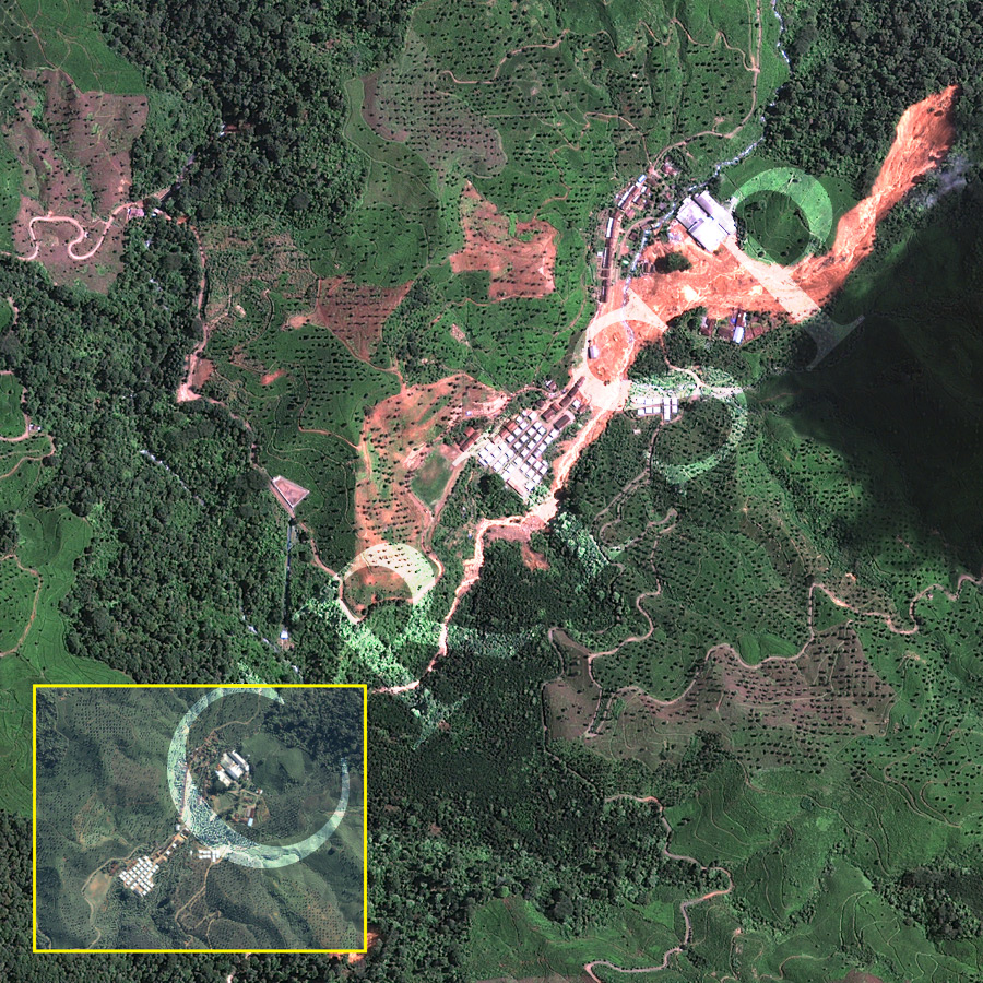
Note: The area of coverage in this GEOEYE-1 image is approximately 1.5 km x 1.5 km.
The reduced resolution image on display has undergone compression and so does not represent the true resolution of the original satellite image.
The steep volcanic slopes of Ciwidey, south of Bandung, west Java bear the red scar from a large landslide on 23 February 2010. The steep volcanic slopes carry tea plantations with large shade trees. Weathered andesite and lava underlying the steep eastern slope failed following heavy rainfall. The failed material travelled rapidly downhill in steps, and spread out at the base of the slope through the tea garden and across the valley of a small river. The bright red sediment downriver from the toe of the landslide contrasts with the lack of fresh sediment in the river channel upstream. The landslide destroyed and buried many houses in the settlement causing many fatalities. The extent of the disaster is evident when the image is compared with the small inset of the area taken from an IKONOS scene of 3 July 2007.