Contrails Over Terengganu, Malaysia
21 January 2011
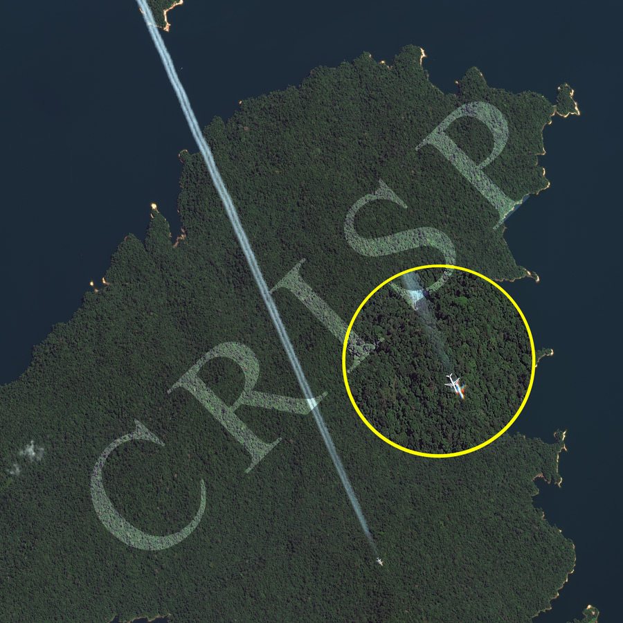
Note: The area of coverage in this WORLDVIEW-2 image is approximately 4.5 km x 4.5 km.
The reduced resolution image on display has undergone compression and so does not represent the true resolution of the original satellite image.
Two clear trails of condensation mark the morning flight path of a twin-engine jet plane over the forests and waters of Tasik Kenyir in Terengganu. Such contrails are seldom captured in a satellite image. The plane and its immediate environment are shown at a higher resolution within the yellow circle. A ‘ghost’ plane appears in front of the physical one, with separation of colours, red towards the front and blue towards the back. The jet was moving at a fast pace while the image was being taken. This has led to an imaging time difference among the different bands of WorldView-2, as the placement of the push-broom sensors of the multiple bands are at different positions on the focal plane of the sensor. We end up having two planes instead of one.