Pulau Baranglompo, Selat Makassar, Sulawesi, Indonesia
8 June 2011
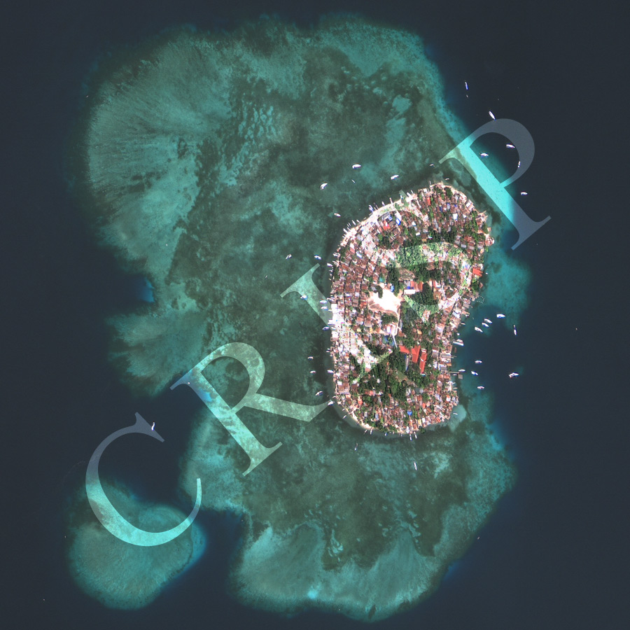
Note: The area of coverage in this GEOEYE-1 image is approximately 1.67 km x 1.67 km.
The reduced resolution image on display has undergone compression and so does not represent the true resolution of the original satellite image.
Baranglompo is one of the larger islands in the chain of coral reefs that is the Spermonde Archipelago, west of Makassar (Ujung Pandang), Sulawesi. The island rises above the water of the Makassar Strait, on the eastern rim of a reef structure, while submerged reefs at various depths extend towards the west. The low elliptical island is densely packed with single-storey houses with reddish tin roofs. Closely packed houses line a series of narrow nested roads circumventing the island. An open field, groves of old trees, a mosque and official buildings are located on the highest part of the island at its centre. The main piers are on the east coast, facing Makassar. The number of little boats and the presence of an extensive coral reef suggest an association with fishing and reef tourism. The island is well-known for the harvesting of sea cucumbers.