Glaciated Landscape, Greater Himalaya, Northern Bhutan
5 December 2010
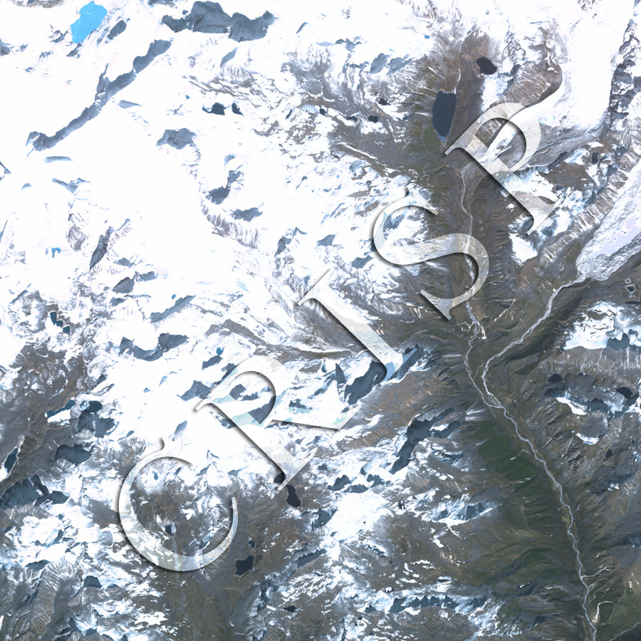
Note: The area of coverage in this SPOT-5 image is approximately 12 km x 12 km.
The reduced resolution image on display has undergone compression and so does not represent the true resolution of the original satellite image.
A north-south valley cuts through the eastern side of the image, with glaciated mountains on either side. The long, flat-floored valley with steep sides was eroded by a large glacier in the past. The current glaciers reach the floor of this valley towards the north, but terminate at its shoulder towards the south. Grey and black cones of rock rise through the ice. Water has filled eroded depressions in front of the glaciers, forming several lakes. These generally are dark, although a few are blue due to scattering of sunlight from high sediment concentration in the water. The high erosion rate in the mountains is also indicated by the extensive accumulation of sediment in front of glaciers, which builds outwash plains and loads the streams. The resulting braided channels shift to a meandering pattern away from the mountains, towards the south.