Part of The Southern Alps, South Island, New Zealand
20 June 2011
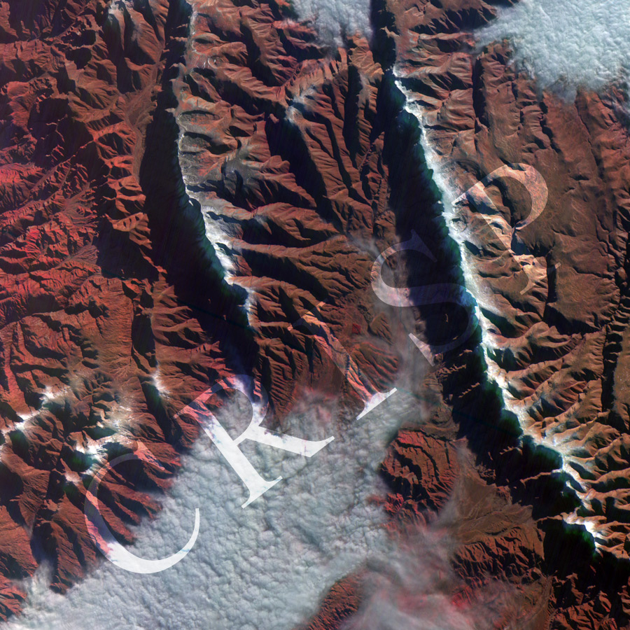
Note: The area of coverage in this XSAT image is approximately 43 km x 43 km.
The reduced resolution image on display has undergone compression and so does not represent the true resolution of the original satellite image.
XSAT, Singapore’s first imaging satellite went into orbit on 20 April 2011. It carries green, red and near infrared bands and has a resolution of 10 m. One of the early images taken by XSAT shows part of the densely dissected mountainous area of the Southern Alps, New Zealand. Two mountain ranges run roughly north-south, separated by valleys. In early winter, the tops of the mountains are under snow, the rocky mid-slopes are bare, and the wider valleys are filled with clouds where the moisture-laden air has condensed. The floors of these valleys are not visible, but elsewhere small streams can be seen depositing alluvial fans at slope breaks. Single-thread streams split into shallower, multi-channel flows over these fans. High erosion and abundant sediment are displayed in the valleys towards the north, where the major valley floors are not cloud covered.