Flood in South Thailand
4 April 2011
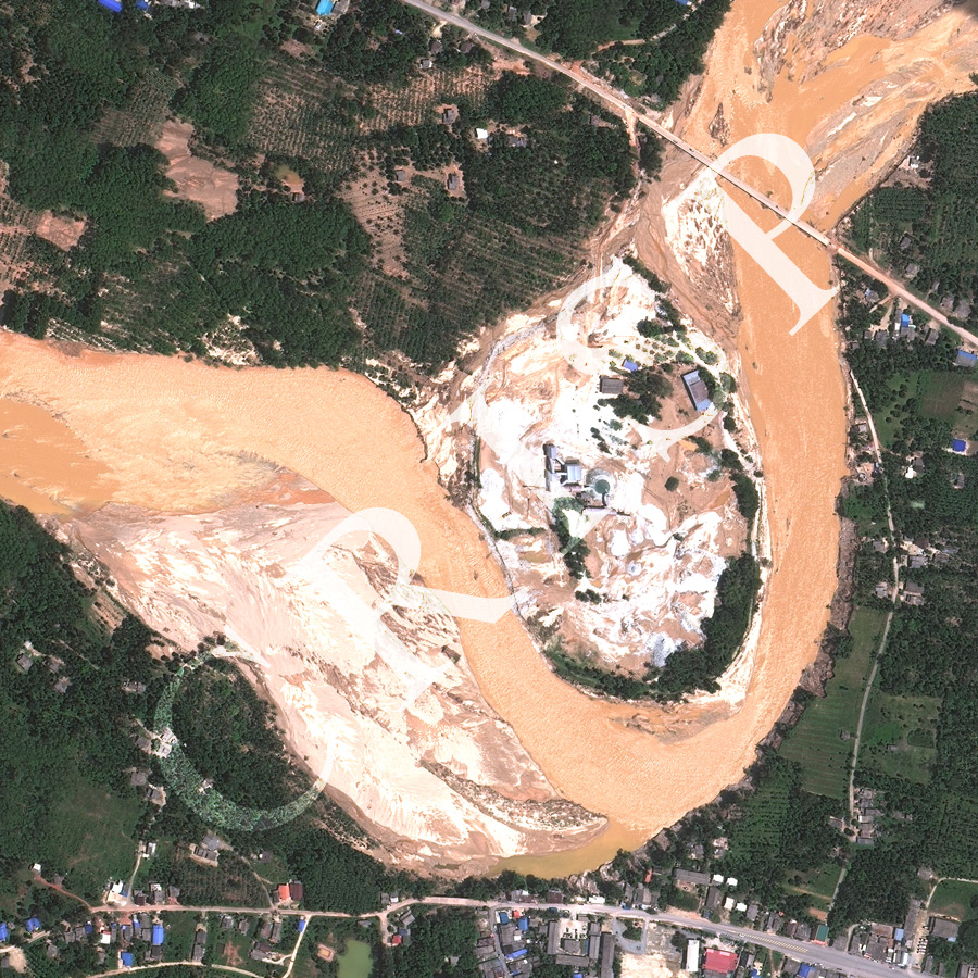
Note: The area of coverage in this WORLDVIEW-2 image is approximately 1.125 km x 1.125 km.
The reduced resolution image on display has undergone compression and so does not represent the true resolution of the original satellite image.
Towards the end of March 2011, nearly 1300 mm of rain fell over north Malaysia and south Thailand in little over a week, leading to widespread regional flooding. The image shows the receding flood on the Tha Sala River, northwest of Nakhon Si Thammarat. A huge amount of sediment was carried in the flood, as shown by the orange colour of the river bed. Sediment on the highway at both ends of the bridge towards the northeast of the image indicates the height of the flood. River-bed dunes, formed in flood sediment, cause the water surface to ripple in the sun. This image, in nearly full resolution, also shows the effect of the flood on a point bar at a meander bend. The flood-widened river straightened its course across its valley, eroding channels on bars, depositing tails of sediment, and collapsing banks.