The Logged Triangle, Riau, Sumatra, Indonesia
25 September 2009
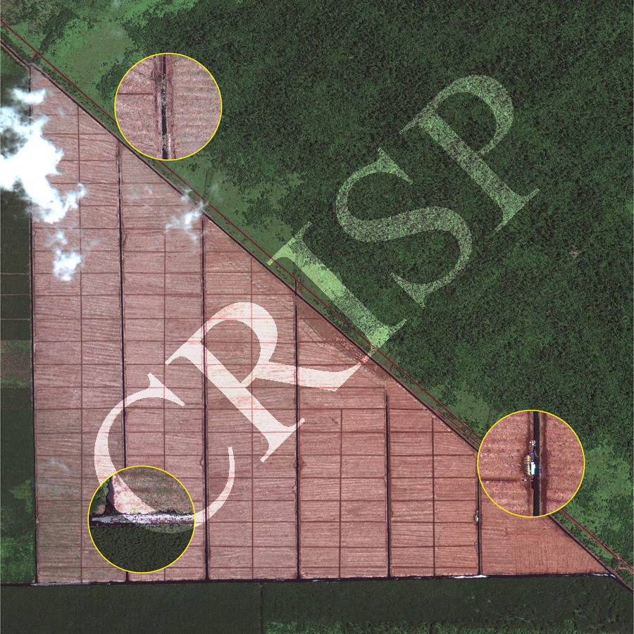
Note: The area of coverage in this GEOEYE-1 image is approximately 3.5 km x 3.5 km.
The reduced resolution image on display has undergone compression and so does not represent the true resolution of the original satellite image.
About half of this image shows a triangular area logged with extreme precision. The other half indicates forested coastal wetland. The three insets at higher resolution demonstrate the details of logging. The insets illustrate logs in 7-8 m wide parallel canals running north-south, jetties and cranes for loading boats with logs, and boats loaded with logs travelling east towards the nearby Strait of Malacca. A second set of canals, much narrower with the width of only one metre and criss-crossing each other at right angles, complete the geometry of the logged area. The geometric precision, a complete clearance of the trees, and the level of land preparation suggest that this is an intensive economic endeavour, a plantation of commercial trees.