Dissected Landscape Of Upper Hwang He Basin, China
14 August 2009
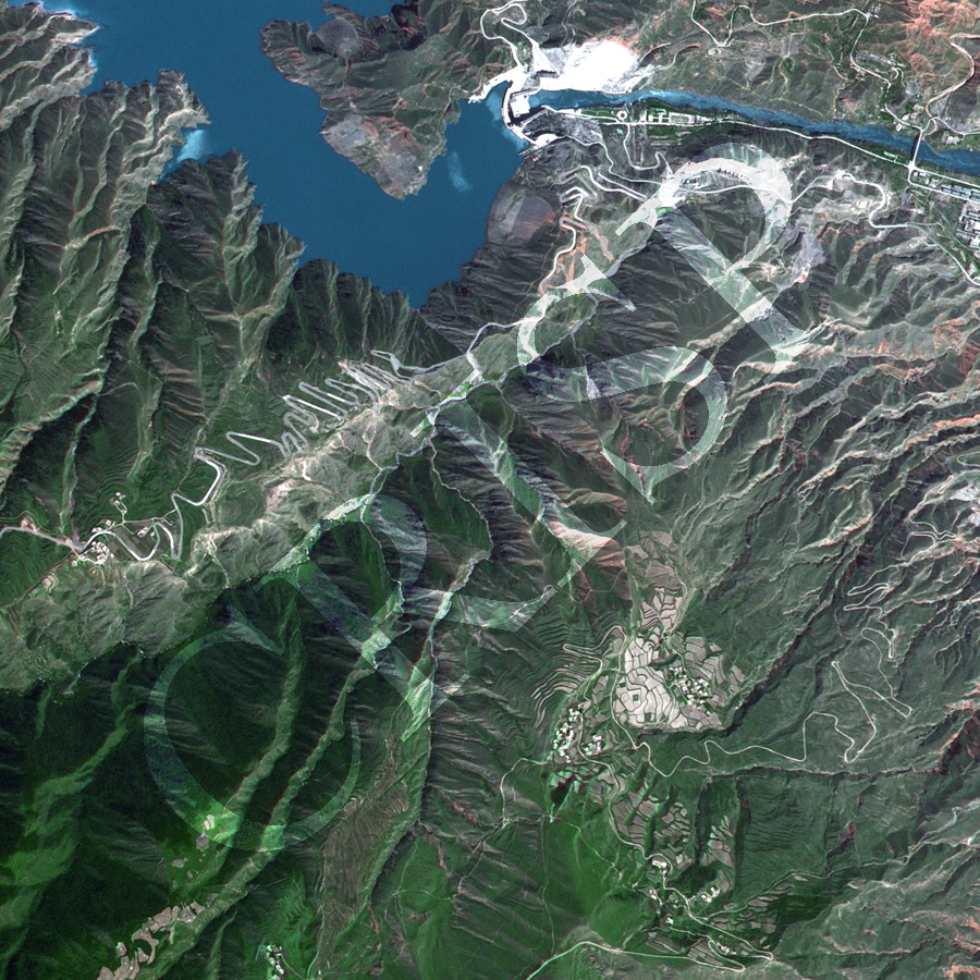
Note: The area of coverage in this SPOT-5 image is approximately 5 km x 5 km.
The reduced resolution image on display has undergone compression and so does not represent the true resolution of the original satellite image.
This thinly populated mountainous area of steep slopes, narrow ridges, and deep valleys is located south of Xining and west of Lanzhou. Part of a reservoir covers the northwestern corner of the image behind an arch dam on the upper course of the Huang He. Next to the dam is the Lijiaxia Hydropower Station. The outflow passes through the straight, steep-sided, and probably structure-guided gorge. Roads with innumerable hairpin bends traverse the country, the major one using the dam to cross the river. Nothing illustrates the dissected nature and steep slopes of the region better than the road layouts. The slopes are heavily eroded by mass movements and small streams release plumes of sediment in the reservoir. Scattered attempts at farming have required complicated terracing and slope preservation techniques.