The Mahakam Delta, East Kalimantan, Indonesia
18 February 2010
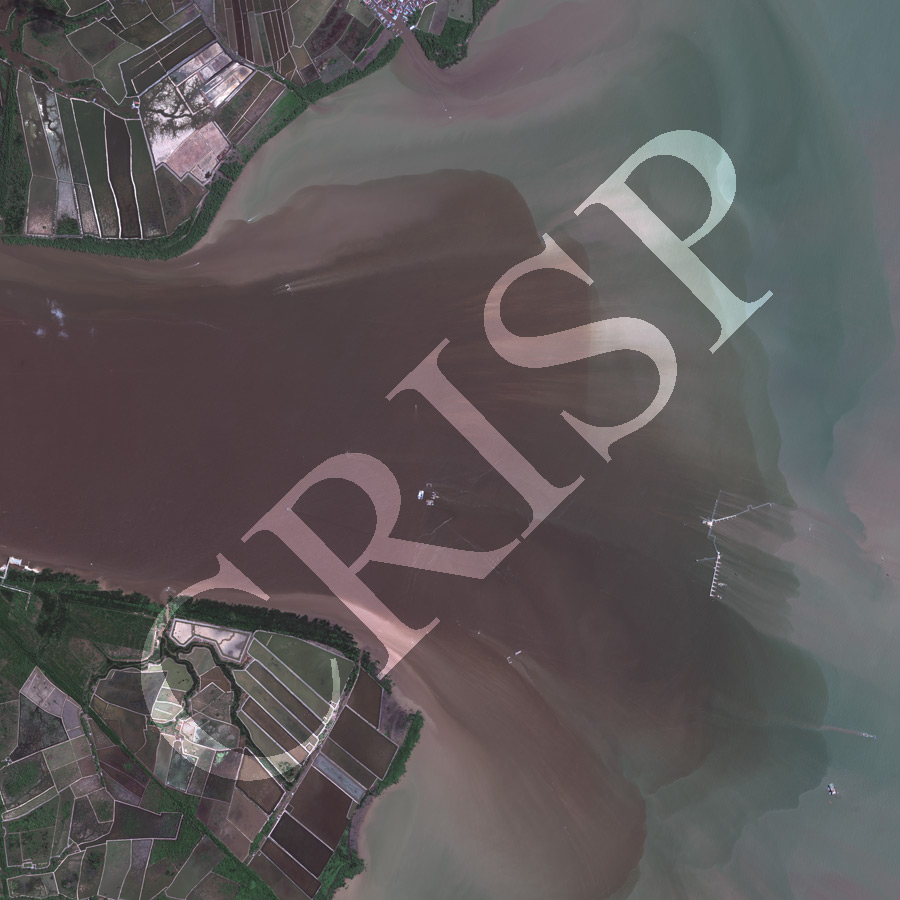
Note: The area of coverage in this GEOEYE-1 image is approximately 6 km x 6 km.
The reduced resolution image on display has undergone compression and so does not represent the true resolution of the original satellite image.
One of the deltaic distributaries of the Mahakam River flows into the Makassar Strait. The Mahakam has a tide-dominated delta with funnel-shaped estuaries and a steep offshore slope, both characteristics affecting diffusion of sediment. The brown sediment plume continues from the river mouth into the sea before rapidly mixing with the sea water. Complicated industrial structures have been constructed offshore. A thin strip of mangrove survives round the edge of the land. Inland, mangrove has been replaced by ponds for growing fish and prawns. Several of the tanks are filled with water and probably in operation but a number of them show decaying mangrove indicating this to be a fairly new venture. A number of boats and possibly houses on stilts occur in a small channel towards the north.