Sand Transport In The Tuguilan River Wash, Northwest Mindoro, Philippines
29 March 2010
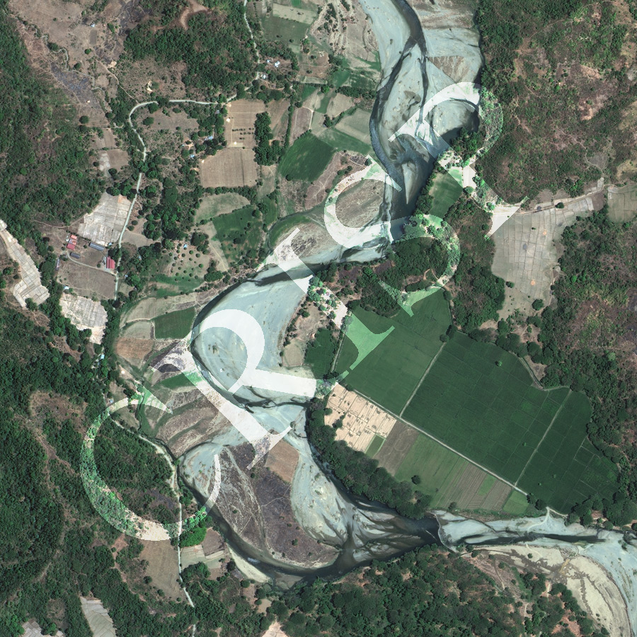
Note: The area of coverage in this WORLDVIEW-2 image is approximately 1.5 km x 1.5 km.
The reduced resolution image on display has undergone compression and so does not represent the true resolution of the original satellite image.
The Tuguilan River Wash is one of the streams that flow out of the highlands of northwest Mindoro to the South China Sea. All these streams bring down enormous quantities of sand from a tectonic highland in high flow. The Tuguilan is flowing north-south through the middle of the image in a very wide channel with steep banks. The river is filled with coarse sand with flood overflow channels on top of sand bodies in the channel. The size and form of the river are controlled by episodic floods that carry a large supply of coarse sediment. The post-flood river flows round the sand bars in a smaller channel which nests inside the large conduit that carries floods. Steep hill slopes flank the river in places. Elsewhere stretches of valley flats, which probably are isolated patches of floodplain, occur between the river and the hill slopes. These flat areas are cultivated for rice. Paddy fields also climb the lower slopes. Otherwise the slopes are under light forest.