Gunung Batok, Tengger Caldera, East Java, Indonesia
21 August 2009
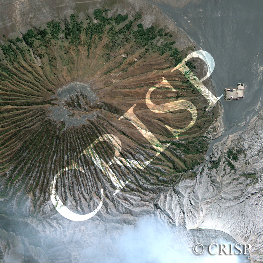
Note: The area of coverage in this GEOEYE-1 image is approximately 1.35 km x 1.35 km.
The reduced resolution image on display has undergone compression and so does not represent the true resolution of the original satellite image.
Mount Batok, a currently inactive 2440 m volcano, rises from the floor of the Tengger caldera. South of it, the crater of Mount Bromo spews out smoke and silvery ashes. Stratifications marking past eruptions are clearly visible inside the crater rim. The silvery white ash of Mount Bromo has spread over the crater floor contrasting with the older volcanic deposits, reddened and darkened by their longer exposure to the atmosphere. Volcanic mudflows and running water from rainfall have eroded innumerable channels through the ash; on the slopes of the Batok these are remarkably regular in appearance. Vegetation is coming back to the lower slopes of this volcano towards the north, away from the eruptions of Mount Bromo. Vegetation elsewhere on the Batok is stunted and commonly found inside the channels. A volcanic observatory post is located to the east of Mount Batok.